Northern Rocky Mountains Provincial Park
| Northern Rocky Mountains Provincial Park | |
|---|---|
|
IUCN category Ib (wilderness area)
|
|
|
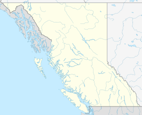
Location of Northern Rocky Mountains Park in BC
|
|
| Location | British Columbia, Canada |
| Nearest city | Fort Nelson |
| Coordinates | 58°13′16″N 124°21′12″W / 58.22111°N 124.35333°WCoordinates: 58°13′16″N 124°21′12″W / 58.22111°N 124.35333°W |
| Area | 6,657.1 km2 |
| Established | June 1999 |
| Governing body | BC Parks |
Northern Rocky Mountains Provincial Park is a provincial park in British Columbia, Canada. It is located in the north-eastern part of the province, 90 km south-west from Fort Nelson and it is bordered to the north by the Alaska Highway. Access is mostly done by boat, aircraft, on horseback or by hiking.
At 6,657.1 km2, it is the largest protected area in the Muskwa-Kechika Management Area and the third largest provincial park in British Columbia. The park borders Stone Mountain Provincial Park to the north-west and Kwadacha Wilderness Provincial Park to the south-west, creating a large contiguous protected area in the Muskwa Ranges of the Canadian Rockies.
The area is notable for a range of water features including rivers, streams, waterfalls, rapids, small glaciers and lakes. Its rivers include the Tetsa, Chischa, and Muskwa, and its creeks include the Gathto, Kluachesi, Dead Dog and Chlotapecta.
The largest water features in the area are the upper and lower Tuckodi Lakes , though other lakes such as Kluachesi and Tetsa exist.
A range of activities is welcome, though most opportunities require experience in and knowledge of the wilderness.
...
Wikipedia

