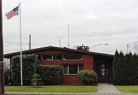
North Plains, Oregon
| North Plains, Oregon | ||
|---|---|---|
| City | ||

City Hall
|
||
|
||
| Nickname(s): City to the Sunset | ||
 Location in Oregon |
||
| Coordinates: 45°35′50″N 122°59′53″W / 45.59722°N 122.99806°WCoordinates: 45°35′50″N 122°59′53″W / 45.59722°N 122.99806°W | ||
| Country | United States | |
| State | Oregon | |
| County | Washington | |
| Incorporated | 1963 | |
| Government | ||
| • Mayor | David Hatcher | |
| Area | ||
| • Total | 0.90 sq mi (2.33 km2) | |
| • Land | 0.90 sq mi (2.33 km2) | |
| • Water | 0 sq mi (0 km2) | |
| Elevation | 176 ft (53.6 m) | |
| Population (2010) | ||
| • Total | 1,947 | |
| • Estimate (2012) | 2,013 | |
| • Density | 2,163.3/sq mi (835.3/km2) | |
| Time zone | Pacific (UTC-8) | |
| • Summer (DST) | Pacific (UTC-7) | |
| ZIP code | 97133 | |
| Area code(s) | 503 | |
| FIPS code | 41-53150 | |
| GNIS feature ID | 1163180 | |
| Website | www.northplains.org | |
North Plains is a city in Washington County, Oregon, United States, off U.S. 26 on the northwest outskirts of the Portland metropolitan area. The population was 1,947 at the 2010 census.
What was to become the city of North Plains was first platted in September 1910 by the Ruth Trust Company of Portland, which purchased area tracts after James J. Hill made plans to extend United Railways there.
Pumpkin Ridge Golf Club, located just outside town, was where David Duval won the Nike Tour Championship in 1993, and was home to the U.S. Women's Open in 1997 and 2003. Horning's Hideout within the North Plains area was home to Faerieworlds Festival 2004
According to the United States Census Bureau, the city has a total area of 0.90 square miles (2.33 km2), all land.
This region experiences warm (but not hot) and dry summers, with no average monthly temperatures above 71.6 °F (22.0 °C). According to the Köppen Climate Classification system, North Plains has a warm-summer Mediterranean climate, abbreviated "Csb" on climate maps.
As of the census of 2010, there were 1,947 people (a 21.3% increase from 2000), 706 households, and 511 families residing in the city. The population density was 2,163.3 inhabitants per square mile (835.3/km2). There were 749 housing units at an average density of 832.2 per square mile (321.3/km2). The racial makeup of the city was 89.0% White, 0.4% African American, 1.2% Native American, 1.8% Asian, 0.6% Pacific Islander, 3.1% from other races, and 3.7% from two or more races. Hispanic or Latino of any race were 11.0% of the population.
...
Wikipedia

