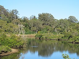
North Pine River
| North Pine | |
| River | |
|
The river at Petrie, 2016
|
|
| Country | Australia |
|---|---|
| State | Queensland |
| Region | South East Queensland |
| Part of | Pine River catchment |
| Tributaries | |
| - left | Yogi Creek |
| - right | Laceys Creek, Kobble Creek |
| Source | D'Aguilar Range |
| - location | below Bootawa |
| - elevation | 480 m (1,575 ft) |
| - coordinates | 27°06′47″S 152°44′07″E / 27.11306°S 152.73528°E |
| Mouth | confluence with the South Pine River to form the Pine River |
| - location | Lawnton |
| - elevation | 10 m (33 ft) |
| - coordinates | 27°17′16″S 153°00′57″E / 27.28778°S 153.01583°ECoordinates: 27°17′16″S 153°00′57″E / 27.28778°S 153.01583°E |
| Length | 54 km (34 mi) |
| Reservoir | Lake Samsonvale |
|
Location of the North Pine River mouth in Queensland
|
|
The North Pine River is a minor river located in South East Queensland, Australia.
The North Pine River rises in the D'Aguilar Range in the Mount Mee State Forest, approximately 50 km (31 mi) northwest of Brisbane, and flows generally southeast to form its confluence with the South Pine River at Lawnton, where the river forms the Pine River. The river flows mostly through the Moreton Bay Region, just to the south of Dayboro. Along with Kobble Creek it is dammed at Whiteside to form the North Pine Dam, an artificial lake called Lake Samsonvale. This catchment provides drinking water to Redcliffe, Pine Rivers, Caboolture and the northern suburbs of Brisbane.
After the North Pine Dam, the North Pine River continues through the suburbs of Petrie and Lawnton, where it meets with the South Pine River and forms the Pine River, flowing into Bramble Bay. The river descends 470 metres (1,540 ft) over its 54-kilometre (34 mi) course.
The former Pine Rivers Shire draws its name from the North Pine, South Pine and Pine Rivers.
In the early 1930s timber for the construction of the Hornibrook Bridge was brought down the North Pine River to Bramble Bay via barge.Lake Kurwongbah was built in 1984 on Sideling Creek, a tributary of the North Pine River.
...
Wikipedia


