Nitra county
| Nitra Region | |||
|---|---|---|---|
| Region | |||
 |
|||
|
|||
 Nitra Region |
|||
| Country | Slovakia | ||
| Capital | Nitra | ||
| Area | |||
| • Total | 6,343.94 km2 (2,449.41 sq mi) | ||
| Highest elevation | 943 m (3,094 ft) | ||
| Population (2011 census) | |||
| • Total | 689,867 | ||
| • Density | 110/km2 (280/sq mi) | ||
| Time zone | CET (UTC+1) | ||
| • Summer (DST) | CEST (UTC+2) | ||
| ISO 3166 code | SK-NI | ||
| Website | www |
||
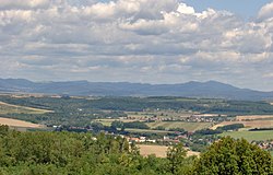
The Nitra Region (Slovak: Nitriansky kraj, pronounced [ˈɲitrianski ˈkraj]; Hungarian: Nyitrai kerület) is one of the administrative regions of Slovakia. It was first established in 1923 and from 1996 exists in its present borders. It consists of seven districts /okresy/ and 354 municipalities, from which 15 have a town status. The economy of the region focuses more on agriculture, than in other Slovak regions. Nitra is its seat, largest city, and cultural and economic center.
This region with a long history is situated in the southwest of Slovakia, mostly in the eastern part of the Danubian Lowland. It is divided into two sub-units: the Danubian Flat in the south-west, with eastern part of the Žitný ostrov island, and the Danubian Hills in the north, centre and east. Mountain ranges reaching into the region are: Považský Inovec in the north-west, where the region's highest point, Veľký Inovec, is located, Tribeč in the north from Nitra, Pohronský Inovec in the north-east and Štiavnické vrchy in the east. Major rivers are the Danube in the south, Váh in the south-west, Nitra in the western-central part, Hron in the east and Ipeľ in the south-east. As for administrative divisions, the region borders Trenčín Region in the north, Banská Bystrica Region in the east, Hungarian Pest in the south-east, Komárom-Esztergom in the south, and Győr-Moson-Sopron county in the south-west and Trnava Region in the west.
...
Wikipedia


