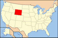
Niobrara County, Wyoming
| Niobrara County, Wyoming | |
|---|---|
 Location in the U.S. state of Wyoming |
|
 Wyoming's location in the U.S. |
|
| Founded | 1913 |
| Named for | Niobrara River |
| Seat | Lusk |
| Largest town | Lusk |
| Area | |
| • Total | 2,628 sq mi (6,806 km2) |
| • Land | 2,626 sq mi (6,801 km2) |
| • Water | 1.9 sq mi (5 km2), 0.07% |
| Population (est.) | |
| • (2015) | 2,542 |
| • Density | 0.9/sq mi (0/km²) |
| Congressional district | At-large |
| Time zone | Mountain: UTC-7/-6 |
| Website | www |
Niobrara County is a county located in the U.S. state of Wyoming. As of the 2010 census, the population was 2,484, making it the least populous county in Wyoming. Its county seat is Lusk. It is west from the Nebraska-South Dakota state line.
Niobrara County was created on February 21, 1911, with land detached from Converse County, and organized in 1913.
The county was named for the Niobrara River, which takes its source near the county seat of Lusk.
According to the U.S. Census Bureau, the county has a total area of 2,628 square miles (6,810 km2), of which 2,626 square miles (6,800 km2) is land and 1.9 square miles (4.9 km2) (0.07%) is water.
In comparison to the state of Rhode Island, the county has more than twice the land area, with approximately 1/500 of the population.
As of the census of 2000, there were 2,407 people, 1,011 households, and 679 families residing in the county. The population density was 1 person per square mile (2.6/km²). There were 1,338 housing units at an average density of 0 per square mile (0/km²). The racial makeup of the county was 98.05% White, 0.12% Black or African American, 0.50% Native American, 0.12% Asian, 0.50% from other races, and 0.71% from two or more races. 1.50% of the population were Hispanic or Latino of any race. 35.1% were of German, 18.7% English, 11.2% Irish and 5.7% American ancestry.
...
Wikipedia
