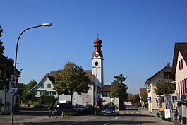
Niederwil, Aargau
| Niederwil | ||
|---|---|---|
 |
||
|
||
| Coordinates: 47°23′N 8°18′E / 47.383°N 8.300°ECoordinates: 47°23′N 8°18′E / 47.383°N 8.300°E | ||
| Country | Switzerland | |
| Canton | Aargau | |
| District | Bremgarten | |
| Area | ||
| • Total | 6.15 km2 (2.37 sq mi) | |
| Elevation | 405 m (1,329 ft) | |
| Population (Dec 2015) | ||
| • Total | 2,761 | |
| • Density | 450/km2 (1,200/sq mi) | |
| Postal code | 5524 | |
| SFOS number | 4072 | |
| Surrounded by | Fischbach-Göslikon, Hägglingen, Künten, Stetten, Tägerig, Wohlen | |
| Website |
www SFSO statistics |
|
Niederwil is a municipality in the district of Bremgarten in the canton of Aargau in Switzerland.
The first traces of human settlement near Niederwil are several scattered neolithic stones axes. During the Roman era, there was a small settlement. Near the church is the ruins of a Roman era wall, and there was a Roman treasury at what is now Riedmatte. An iron spearhead from the 7th Century was discovered in the municipality, but all details of the discovery have been lost.
The village of Niederwil is first mentioned in 924 as Wilare. The rights to high justice were held throughout the High and Late Middle Ages by the Counts of Lenzburg. Following their extinction, the rights were held by the House of Habsburg, and after the 1415 conquest of Aargau, they were held by the Old Swiss Confederation. The rights to low justice were held by Schänis Abbey in Gaster.
Niederwil has an area, as of 2006[update], of 6.1 square kilometers (2.4 sq mi). Of this area, 53% is used for agricultural purposes, while 30.4% is forested. Of the rest of the land, 14.1% is settled (buildings or roads) and the remainder (2.5%) is non-productive (rivers or lakes).
The municipality is located in the Bremgarten district on the left bank of the Reuss river. It consists of the village of Niederwil and since 1901, the village of Nesselnbach and the former Gnadental convent.
...
Wikipedia


