Nez Perce National Forest
| Nez Perce National Forest | |
|---|---|
|
IUCN category VI (protected area with sustainable use of natural resources)
|
|

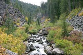
Crooked Creek in Gospel Hump Wilderness
|
|
| Location | Idaho County, Idaho, United States |
| Nearest city | Grangeville, Idaho |
| Coordinates | 45°27′N 115°55′W / 45.450°N 115.917°WCoordinates: 45°27′N 115°55′W / 45.450°N 115.917°W |
| Area | 2,224,091 acres (9,000.58 km2) |
| Established | July 1, 1908 |
| Governing body | U.S. Forest Service |
| Website | Nez Perce-Clearwater National Forests |
The Nez Perce National Forest is a 2,224,091-acre (9,000.58 km2) United States National Forest located in west-central Idaho. The forest is bounded on the east by the state of Montana, on the north by the Clearwater National Forest, on the west by a portion of the Wallowa–Whitman National Forest and on the south by the Payette National Forest.
The mountains in this forest provide wildlife habitat for timber wolf, raccoon, moose, black bear, coyote, cougar, elk, two species of fox, bald eagle, pika, beaver, flammulated owl, pine marten, white-tailed and mule deer, muskrat, river otter, peregrine falcon, mink, marmot, fisher, and mountain goat.
In 2012, Nez Perce National Forest and Clearwater National Forest were administratively combined as Nez Perce-Clearwater National Forests, with headquarters in Kamiah, Idaho. There are local ranger district offices in Elk City, Grangeville, Kooskia, and White Bird.
...
Wikipedia

