Newport Wetlands Reserve
| Newport Wetlands | |
|---|---|
| Wlyptiroedd Casnewydd | |

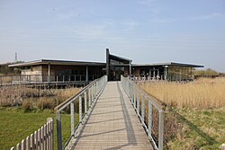
Wetlands visitor centre, West Nash, Newport
|
|
| Type | National nature reserve |
| Nearest city | Newport, Wales |
| Coordinates | 51°32′46″N 2°57′40″W / 51.546°N 2.961°WCoordinates: 51°32′46″N 2°57′40″W / 51.546°N 2.961°W |
| Area | 437 hectares (1,080 acres) |
| Created | 2000 |
| Operated by | |
| Blog | rspb |
| Website | rspb |

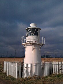
East Usk lighthouse, near Perry Lane, West Nash, Newport
|
|
|
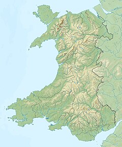
Wales
|
|
| Location |
Uskmouth Newport Wales United Kingdom |
|---|---|
| Coordinates | 51°32′24″N 2°58′01″W / 51.540005°N 2.966974°W |
| Year first constructed | 1893 |
| Construction | cast iron tower |
| Tower shape | cylindrical tower with balcony and lantern |
| Markings / pattern | white tower and lantern |
| Height | 13 metres (43 ft) |
| Focal height | 11 metres (36 ft) |
| Light source | mains power |
| Characteristic | Fl (2) WRG 10s. |
| Admiralty number | A5454 |
| NGA number | 5904 |
| ARLHS number | WAL-005 |
| Managing agent |
Newport Harbour Commissioners |
Newport Wetlands is a wildlife reserve covering parts of Uskmouth, Nash and Goldcliff, in the south-east of the city of Newport, South Wales.
The reserve was established in 2000 to mitigate losses of wildlife habitat when the Cardiff Bay Barrage scheme was undertaken.
The site is owned and managed by Natural Resources Wales, the successor body to the Countryside Council for Wales. A purpose-built visitor and education centre for the site was opened, in West Nash, in March 2008 by the Royal Society for the Protection of Birds (RSPB) with help from Newport City Council and water level management assistance by Caldicot and Wentloog Levels Internal Drainage Board.
The reserve covers 437 hectares (1,080 acres) of the Caldicot Level, a low-lying area of land bordering the northern shore of the Severn Estuary. Part of the site is a reclaimed fuel ash disposal site, although some farmland in Goldcliff and Nash has also had to be flooded to complete the work.
The reserve was made a national nature reserve on 16 April 2008.
Entrance is free, with car parking facilities open every day of the year from 8:30 am until 5:30 pm. The visitor and education centre opening hours are 9:00 am until 5:00 pm (except Christmas day).
...
Wikipedia


