Newcastle, Natal
| Newcastle | |||||||
|---|---|---|---|---|---|---|---|
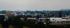
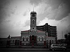
From the top: Downtown Newcastle City Skyline from Fort Amiel Museum, Sculpture by Mohau Modisakeng at Entrance 03 of the Newcastle Mall, Newcastle City Hall, Newcastle from Hilldrop and Arcelor Mittal Newcastle Works
|
|||||||
|
|
|||||||
| Coordinates: 27°44′47″S 29°55′58″E / 27.74639°S 29.93278°ECoordinates: 27°44′47″S 29°55′58″E / 27.74639°S 29.93278°E | |||||||
| Country | South Africa | ||||||
| Province | KwaZulu-Natal | ||||||
| District | Amajuba | ||||||
| Municipality | Newcastle | ||||||
| Established | 1864 | ||||||
| Government | |||||||
| • Mayor | Makhosini Nkosi (African National Congress) | ||||||
| Area | |||||||
| • Total | 75.79 km2 (29.26 sq mi) | ||||||
| Elevation | 1,194 m (3,917 ft) | ||||||
| Population (2011) | |||||||
| • Total | 56,144 | ||||||
| • Density | 740/km2 (1,900/sq mi) | ||||||
| Racial makeup (2011) | |||||||
| • Black African | 51.9% | ||||||
| • Coloured | 3.8% | ||||||
| • Indian/Asian | 19.8% | ||||||
| • White | 23.6% | ||||||
| • Other | 0.9% | ||||||
| First languages (2011) | |||||||
| • Zulu | 37.4% | ||||||
| • English | 35.4% | ||||||
| • Afrikaans | 20.7% | ||||||
| • Sotho | 1.0% | ||||||
| • Other | 5.5% | ||||||
| Postal code (street) | 2940 | ||||||
| PO box | 2940 | ||||||
| Area code | 034 | ||||||
| Website | www |
||||||
Newcastle is the third-largest city in the province of KwaZulu-Natal, South Africa, with a population of 363,236 citizens as of the 2011 census. 56,144 of these citizens reside in Newcastle West, whilst the balance of the population reside in the main townships of Madadeni and Osizweni, which form Newcastle East.
Set at the picturesque foothills of the northern KwaZulu-Natal Drakensberg Mountains, Newcastle is located in the north west corner of the province along the Ncandu River and is one of the country's main industrial centers.
Newcastle's municipal area is 188 square kilometres (73 square miles), consists of 31 wards and a population growth rate of 0.87%, ranking Newcastle as South Africa's tenth-largest city.
The N11 and R34 are the principal roads linking the city to the rest of South Africa.
Newcastle is the seat of the local municipality as well as being the seat to the Amajuba District Municipality.
Newcastle has changed names on numerous occasions during the country's historic rule. It was initially named Post Halt Number 2 on military maps during the 1840s, as postal coaches stopped here to obtain fresh horses on the journey between Durban (then Port Natal in Zuid-Afrikaansche Republiek) and Johannesburg. It was later known as the Waterfall River Township because of the Ncandu River. Newcastle received her name after the British Colonial Secretary, the fifth Duke of Newcastle, a British aristocrat, and not the city in England as some believe. During the Anglo-Boer War, Newcastle was invaded by Boer forces on 14 October 1899, and the entire district was incorporated into the Transvaal Republic. Newcastle's name lasted for a period of seven months when it was renamed to Viljoensdorp after the commander of the Johannesburg Commando, General Ben Viljoen. However, after relief of Ladysmith under the command of General Redver Buller, the British forces reclaimed the name back to Newcastle.
...
Wikipedia


