Newark, Ohio
| Newark, Ohio | |
|---|---|
| City | |

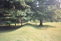
A section of the Newark Great Circle
|
|
| Nickname(s): "Nerk" | |
 Location of Newark in Licking County and State of Ohio |
|
| Coordinates: 40°3′47″N 82°25′0″W / 40.06306°N 82.41667°WCoordinates: 40°3′47″N 82°25′0″W / 40.06306°N 82.41667°W | |
| Country |
|
| State |
|
| County | Licking |
| Government | |
| • Mayor | Jeff Hall |
| Area | |
| • Total | 21.37 sq mi (55.35 km2) |
| • Land | 20.88 sq mi (54.08 km2) |
| • Water | 0.49 sq mi (1.27 km2) |
| Elevation | 833 ft (254 m) |
| Population (2010) | |
| • Total | 47,573 |
| • Estimate (2015) | 47,986 |
| • Density | 2,278.4/sq mi (879.7/km2) |
| Time zone | Eastern (EST) (UTC-5) |
| • Summer (DST) | EDT (UTC-4) |
| ZIP codes | 43055, 43056, 43058, 43093 |
| Area code(s) | 740, 220 |
| FIPS code | 39-54040 |
| GNIS feature ID | 1065144 |
| Website | http://www.newarkohio.net/ |
Newark is a city in and the county seat of Licking County, Ohio, United States, 33 miles (53 km) east of Columbus, at the junction of the forks of the Licking River. The population was 47,573 at the 2010 census which makes it the 20th largest city in Ohio.
Newark is located at 40°3′47″N 82°25′0″W / 40.06306°N 82.41667°W (40.063014, −82.416779).
In terms of population, Newark is the second-largest Newark in the United States, after Newark, New Jersey. It is not part Columbus, Ohio metropolitan area.
According to the United States Census Bureau, the city has a total area of 21.37 square miles (55.35 km2), of which 20.88 square miles (54.08 km2) is land and 0.49 square miles (1.27 km2) is water.
The median income for a household in the city was $19,791, and the median income for a family was $42,138. Males had a median income of $18,542 versus $12,868 for females. The per capita income for the city was $17,819. About 10.1% of families and 13.0% of the population were below the poverty line, including 17.9% of those under age 18 and 9.0% of those age 65 or over.
As of the census of 2010, there were 47,573 people, 19,840 households, and 12,057 families residing in the city. The population density was 2,278.4 inhabitants per square mile (879.7/km2). There were 21,976 housing units at an average density of 1,052.5 per square mile (406.4/km2). The racial makeup of the city was 92.8% White, 3.3% African American, 0.3% Native American, 0.6% Asian, 0.3% from other races, and 2.6% from two or more races. Hispanic or Latino of any race were 1.2% of the population.
...
Wikipedia
