New York State Route 409
| New York State Route 409 | ||||
|---|---|---|---|---|

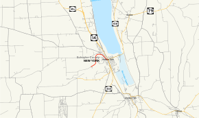
Map of Schuyler County in central New York with NY 409 highlighted in red
|
||||
| Route information | ||||
| Maintained by NYSDOT | ||||
| Length: | 1.65 mi (2.66 km) | |||
| Existed: | by 1970 – present | |||
| Major junctions | ||||
| West end: | Norfolk Southern grade crossing in Dix | |||
| East end: |
|
|||
| Location | ||||
| Counties: | Schuyler | |||
| Highway system | ||||
|
||||
New York State Route 409 (NY 409) is a state highway in Schuyler County, New York, in the United States. It is more of a spur route as it is connected to the state highway system at only one end. It begins at a grade crossing with the Norfolk Southern Railway in the town of Dix and ends in downtown Watkins Glen at a junction with NY 14 and NY 414. Its western terminus is also the upper entrance to the gorge at Watkins Glen State Park. NY 409 is known as Station Road in Dix and as Steuben Street and West 4th Street in Watkins Glen. The route was assigned by 1970 and follows part of the original Watkins Glen Grand Prix Course.
NY 409 begins at a grade crossing with the Norfolk Southern Railway in the town of Dix, where maintenance of Station Road shifts from Dix to the New York State Department of Transportation. The route initially heads to the northeast through an isolated rural area, running along the northern fringe of Watkins Glen State Park to the western edge of a valley overlooking Seneca Lake and the village of Watkins Glen. Here, NY 409 turns northward, slowly descending into the gorge as it crosses into the town of Reading. After 0.5 miles (0.8 km), the route curves back to the east and rapidly descends in elevation on its way into the village of Watkins Glen.
...
Wikipedia

