New Garden Township, Pennsylvania
| New Garden Township | |
| Township | |
|
Merestone, a historic estate in the township
|
|
| Country | United States |
|---|---|
| State | Pennsylvania |
| County | Chester |
| Elevation | 472 ft (143.9 m) |
| Coordinates | 39°50′08″N 75°46′01″W / 39.83556°N 75.76694°WCoordinates: 39°50′08″N 75°46′01″W / 39.83556°N 75.76694°W |
| Area | 16.2 sq mi (42.0 km2) |
| - land | 16.1 sq mi (42 km2) |
| - water | 0.1 sq mi (0 km2), 0.62% |
| Population | 11,984 (2010) |
| Density | 744.3/sq mi (287.4/km2) |
| Timezone | EST (UTC-5) |
| - summer (DST) | EDT (UTC-4) |
| Area code | 610 |
|
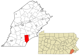
Location in Chester County and the state of Pennsylvania.
|
|
|
Location of Pennsylvania in the United States
|
|
|
Website: www |
|
New Garden Township is a township in Chester County, Pennsylvania, United States which was organized in 1714. The population was 11,984 at the 2010 census. New Garden is the center of the mushroom agribusiness in southeastern Pennsylvania with a higher concentration of composting, mushroom growing, packaging, and shipping businesses than in any other municipality in the area. It was named for the New Garden Friends' Meeting House, an eighteenth-century brick house of worship of the Religious Society of Friends, within its territorial limits.
Merestone was added to the National Register of Historic Places in 1995.
According to the United States Census Bureau, the township has a total area of 16.2 square miles (42 km2), of which 16.1 square miles (42 km2) is land and 0.1 square miles (0.26 km2), or 0.31%, is water.
At the 2010 census, the township was 66.8% non-Hispanic White, 3.0% Black or African American, 0.5% Native American, 3.0% Asian, and 2.2% were two or more races. 26.4% of the population were of Hispanic or Latino ancestry.
As of the census of 2000, there were 9,083 people, 2,700 households, and 2,200 families residing in the township. The population density was 562.9 people per square mile (217.3/km²). There were 2,831 housing units at an average density of 175.5/sq mi (67.7/km²). The racial makeup of the township was 84.91% White, 3.67% African American, 0.41% Native American, 1.30% Asian, 0.04% Pacific Islander, 8.07% from other races, and 1.61% from two or more races. Hispanic or Latino of any race were 22.73% of the population.
...
Wikipedia


