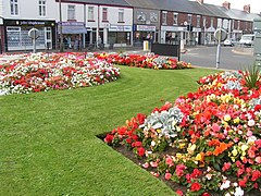
New Delaval
| Seaton Delaval | |
|---|---|
 Seaton Delaval |
|
| Seaton Delaval shown within Northumberland | |
| Population | 4,371 (2001) |
| OS grid reference | NZ3477 |
| Civil parish | |
| Unitary authority | |
| Ceremonial county | |
| Region | |
| Country | England |
| Sovereign state | United Kingdom |
| Post town | WHITLEY BAY |
| Postcode district | NE25 |
| Dialling code | 0191 |
| Police | Northumbria |
| Fire | Northumberland |
| Ambulance | North East |
| EU Parliament | North East England |
| UK Parliament | |
Seaton Delaval is a village in Northumberland, England, with a population of 4,371. It is the largest of the five villages in Seaton Valley and is the site of Seaton Delaval Hall, the masterpiece completed by Sir John Vanbrugh in 1727.
The place-name 'Seaton Delaval' was first attested as 'Seton de la Val' in 1270. 'Seaton' simply means 'sea town', referring to the village's nearness to the North Sea. The land was held by the Delaval family, who took their name from Laval in Maine in France. Their descendants are still major landholders in the area today, and the current Lord Hastings has the first name Delaval: he is Delaval Astley, 23rd Baron Hastings.
The folk song "Blackleg Miner" mentions the village:
From 1974 the village was part of the Blyth Valley borough, but as part of the 2009 structural changes to local government in England responsibility was transferred to Northumberland County Council. The village is in the NE25 post code area and the postal town of Whitley Bay, Tyne and Wear. Unlike other parts of Northumberland, Seaton Delaval and the surrounding villages use the Tyne and Wear 0191 area code.
The village is centred on the intersection of two main roads: the A192 road running from North Shields to Morpeth and the A190 road running from the Dudley village bypass to Seaton Sluice. These main roads are lined by terraced housing from the turn of the 20th Century, but large post-war and 1970s house development is predominant. There are small pockets of more recent housing and as of August 2012, a new estate of houses is being completed.
...
Wikipedia

