Negrete
| Negrete | |||||
|---|---|---|---|---|---|
| Town and Commune | |||||
|
|||||
| Coordinates (city): 37°35′0″S 72°32′0″W / 37.58333°S 72.53333°WCoordinates: 37°35′0″S 72°32′0″W / 37.58333°S 72.53333°W | |||||
| Country | Chile | ||||
| Region | Bío Bío Region | ||||
| Province | Bío Bío Province | ||||
| Government | |||||
| • Type | Municipality | ||||
| • Alcalde | Javier Melo Márquez (Ind.) | ||||
| Area | |||||
| • Total | 156.5 km2 (60.4 sq mi) | ||||
| Elevation | 71 m (233 ft) | ||||
| Population (2012 Census) | |||||
| • Total | 9,394 | ||||
| • Density | 60/km2 (160/sq mi) | ||||
| • Urban | 5,283 | ||||
| • Rural | 3,296 | ||||
| Sex | |||||
| • Men | 4,414 | ||||
| • Women | 4,165 | ||||
| Area code(s) | (+56) 43 | ||||
| Website | Municipality of Negrete | ||||
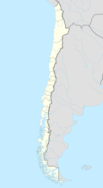
Negrete (Spanish pronunciation: [neˈɣɾete]) is a Chilean town and commune in Bío Bío Province, Bío Bío Region. It is bordered by the commune of Los Ángeles to the north, Renaico to the south, Mulchén to the east and Nacimiento to the west.
The town of Negrete is located on the south shore of the Bío Bío river, a few kilometers downstream of the confluence of the Bío Bío and Bureo rivers.
The town has its origins in the fort San Francisco de Borja founded near the hill Mesamávida in 1603 by Governor Alonso de Ribera. This was 10 km to the northeast of the present location of the town, near the confluence of the Bio Bio River and the Duqueco River, on the north shore of this last river. In 1613 Ribera moved to the fort to atop Mesamávida, renamed Cerro Negrete. In 1621, Pedro Osores de Ulloa rebuilt the fort and a small village began at the base of the hill. In 1757, Governor Manuel de Amat y Juniet, granted the town the title of Villa de Negrete. In 1777, a new fort San Agustín de Mesamávida was built on the Cerro Negrete by Ambrosio O' Higgins by order of Governor Agustín de Jáuregui.
...
Wikipedia


