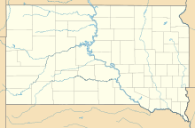
Needles (Black Hills)
| Needles climbing | |
|---|---|

The Needles, South Dakota, United States
|
|
| Nearest city | Custer, South Dakota |
| Range | Black Hills |
| Coordinates | 43°50′28″N 103°32′40″W / 43.84111°N 103.54444°W |
| Climbing type | traditional face and crack climbing and bouldering |
| Height | 500 feet |
| Pitches | 1 to 4 |
| Grades | 5.0-5.13 |
| Rock type | granite, pegmatite |
| Quantity of rock | years worth ( 2,000 summits) |
| Development | well developed |
| Cliff aspect | mixed mainly traditional climbing |
| Season | spring to fall |
| Ownership | State park |
| Camping | none |
| Classic climbs |
Spire Two, 5.3 |
| Stars | |
Spire Two, 5.3
Innercourse, 5.5
Rum Room, 5.7
Tent Peg, 5.7
Tricuni Nail, 5.8
Trojan Determination, 5.8
Behind The Door, 5.9
Four Little Fishes, 5.9
Hardrocker, 5.9
Needle's Eye, 5.10-
Nentucket Sleigh Ride, 5.10
Superpin, 5.10b R
Farewell to Arms, 5.10+
For Whom the Bell Tolls, 5.11a
Limited Immunity, 5.11b
Vertigo, 5.11
Leaning Jowler, 5.12a
Walking the Plankton, 5.12b
Thimble, 5.12a
The Needles of the Black Hills of South Dakota are a region of eroded granite pillars, towers, and spires within Custer State Park. Popular with rock climbers and tourists alike, the Needles are accessed from the Needles Highway, which is a part of Sylvan Lake Road (SD 87/89). The Cathedral Spires and Limber Pine Natural Area, a 637-acre portion of the Needles containing six ridges of pillars as well as a disjunct stand of limber pine, was designated a National Natural Landmark in 1976.
...
Wikipedia

