Nawada district
|
Nawada district नवादा जिला ضلع نوادہ |
|
|---|---|
| District of Bihar | |
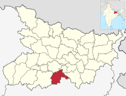
 Location of Nawada district in Bihar |
|
| Country | India |
| State | Bihar |
| Administrative division | Magadh |
| Headquarters | Nawada |
| Government | |
| • Lok Sabha constituencies | Nawada |
| • Assembly seats | Nawada, Hisua, Rajauli, Gobindpur & Warisaliganj. |
| Area | |
| • Total | 2,494 km2 (963 sq mi) |
| Population (2011) | |
| • Total | 2,219,146 |
| • Density | 890/km2 (2,300/sq mi) |
| • Urban | 215,579 (9.7 per cent) |
| Demographics | |
| • Literacy | 59.76 per cent |
| • Sex ratio | 939 |
| Major highways | NH 20, NH 120 |
| Website | Official website |
Nawada district is one of the thirty-eight districts of the Indian state of Bihar. Nawada is its administrative headquarters. The district is the westernmost district of the Magadh division, one of the nine administrative divisions of Bihar. The area of the modern district was historically part of the Magadha, Shunga and Gupta empires. Koderma and Giridih districts of the state of Jharkhand lie on the southern border of the district; it also shares borders with the Gaya, Nalanda, Sheikhpura, and Jamui districts of Bihar.
Kakolat Falls are mentioned in Hindu mythology as the abode of a king turned into a python by a Rishi's curse.
Nawada district occupies an area of 2,494 square kilometres (963 sq mi), comparatively equivalent to Chile's Navarino Island. Most parts of the district are plain but some areas are hilly. The main rivers are the Sakri, Khuri, Panchane, Bhusri by Kakolat and Tilaiya.
Nawada District is divided into 14 blocks:
The main crops harvested in the district are paddy, wheat, pulses, and vegetables. Industrial facilities in the district include bidi factories and silk handlooms. Formerly, sugar cane farming and processing also took place; the district's single sugar mill, located in Warisaliganj, is currently non-functional. Kadirganj, located 10 km from Nawada, has a silk small scale industry where workers clean and weave silk.
...
Wikipedia
