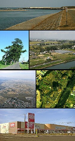
Natori, Miyagi
|
Natori 名取市 |
|||
|---|---|---|---|
| City | |||

Natori River, Andon Matsuri
Teizan-bori, Sendai Airport Raijinyama kofun, Aeontown Natori Shopping Center |
|||
|
|||
 Location of Natori in Miyagi Prefecture |
|||
| Coordinates: 38°10′17.5″N 140°53′30.5″E / 38.171528°N 140.891806°ECoordinates: 38°10′17.5″N 140°53′30.5″E / 38.171528°N 140.891806°E | |||
| Country | Japan | ||
| Region | Tōhoku | ||
| Prefecture | Miyagi | ||
| Government | |||
| • -Mayor | Sasaki Isō | ||
| Area | |||
| • Total | 98.17 km2 (37.90 sq mi) | ||
| Population (September 2015) | |||
| • Total | 77,040 | ||
| • Density | 785/km2 (2,030/sq mi) | ||
| Time zone | Japan Standard Time (UTC+9) | ||
| - Tree | Japanese beech | ||
| - Flower | Peach | ||
| Phone number | 022-384-2111 | ||
| Address | Yanagida 80, Masuda, Natori-shi, Miyagi-ken 981-1292 | ||
| Website | Official website | ||
Natori (名取市 Natori-shi?) is a city located in Miyagi Prefecture, in the Tohoku region of northern Japan. As of September 2015, the city had an estimated population of 77,040 and a population density of 785 persons per km².The total area was 98.17 square kilometres (37.90 sq mi).
Natori is in east-central Miyagi Prefecture, bordered by the Pacific Ocean to the east. Natori is located in the fertile plains of the Natori River and the Masuda River deltas; however, the Natori River is actually not inside Natori city limits. Traditionally, the area known as Natori District extended from the Natori River in the north and into the west. However, these regions have been absorbed into the greater Sendai area and are no longer part of Natori.
The area of present-day Natori was part of ancient Mutsu Province, and was under control of the Date clan of Sendai Domain during the Edo period, under the Tokugawa shogunate. In 1867, Natori came within the borders of the new Rikuzen Province, which later became part of Miyagi Prefecture. With the establishment of the municipalities system on April 1, 1889 Natori District was formed with six villages: Masuda, Higashi-Taga, Shimo-Masuda, Tatekoshi, Aishiwa and Takadate. On April 1, 1896 Masuda was elevated to town status as was Higashi-Taga on April 1, 1928. On April 1, 1955 the towns of Masuda and Yuriage, and the villages of Shimo-Masuda, Tatekoshi, Aishiwa and Takadate were merged to create the town of Natori, which was elevated to city status on October 1, 1958. The official boundaries of Natori City have changed since 1958, as Sendai City redefines its area to include districts to the north and west of Natori.
...
Wikipedia


