Nashua, Iowa
| Nashua, Iowa | |
|---|---|
| City | |
 |
|
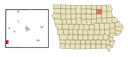
 Location of Nashua, Iowa |
|
| Coordinates: 42°57′8″N 92°32′17″W / 42.95222°N 92.53806°WCoordinates: 42°57′8″N 92°32′17″W / 42.95222°N 92.53806°W | |
| Country |
|
| State |
|
| Counties | Chickasaw, Floyd |
| Area | |
| • Total | 3.14 sq mi (8.13 km2) |
| • Land | 2.88 sq mi (7.46 km2) |
| • Water | 0.26 sq mi (0.67 km2) |
| Elevation | 974 ft (297 m) |
| Population (2010) | |
| • Total | 1,663 |
| • Estimate (2012) | 1,636 |
| • Density | 577.4/sq mi (222.9/km2) |
| Time zone | Central (CST) (UTC-6) |
| • Summer (DST) | CDT (UTC-5) |
| ZIP code | 50658 |
| Area code(s) | 641 |
| FIPS code | 19-55335 |
| GNIS feature ID | 0459437 |
Nashua is a city in Chickasaw and only partly in Floyd counties in the U.S. state of Iowa. As of the 2010 census, the city's population was 1,663 an increase of 45, or 2.8%, from 1,618 reported at the 2000 census. The famed Little Brown Church featured in the song "The Church in the Wildwood" is located in Nashua.
Nashua was incorporated as a city in 1869. It is named after Nashua, New Hampshire, the native town of one of its founders.
Nashua is located at 42°57′8″N 92°32′17″W / 42.95222°N 92.53806°W (42.952231, -92.537944).
According to the United States Census Bureau, the city has a total area of 3.14 square miles (8.13 km2), of which, 2.88 square miles (7.46 km2) is land and 0.26 square miles (0.67 km2) is water.
As of the census of 2010, there were 1,663 people, 712 households, and 456 families residing in the city. The population density was 577.4 inhabitants per square mile (222.9/km2). There were 787 housing units at an average density of 273.3 per square mile (105.5/km2). The racial makeup of the city was 98.6% White, 0.4% African American, 0.5% Asian, and 0.5% from two or more races. Hispanic or Latino of any race were 0.1% of the population.
...
Wikipedia
