Narsinghpur
|
Narsinghpur Narsimhapur |
|
|---|---|
| city | |
| Coordinates: 22°56′53″N 79°11′42″E / 22.948°N 79.195°ECoordinates: 22°56′53″N 79°11′42″E / 22.948°N 79.195°E | |
| Country | India |
| State | Madhya Pradesh |
| District | Narsinghpur |
| Named for | Narsingh temple |
| Area | |
| • Total | 5,125.55 km2 (1,978.99 sq mi) |
| Elevation | 347 m (1,138 ft) |
| Population (2011) | |
| • Total | 1,091,854 |
| • Density | 210/km2 (550/sq mi) |
| Demonym(s) | 920 |
| Languages | |
| • Official | Hindi |
| Time zone | IST (UTC+5:30) |
| Vehicle registration | MP-49 |
| Website | http://narsinghpur.nic.in |
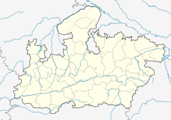
Narsinghpur or Narsimhapur is a town in Madhya Pradesh in central India. It is the headquarter of the Narsinghpur District.
Narsinghpur has a large temple dedicated to Lord Narsingh, constructed by Jat Sardars in the 18th century. The Khirwar clan of Jats came from Brij and founded Narsinghpur, where they ruled for many years. Khirwars of Narsinghpur were followers of Narasimha, and so constructed two temples dedicated to Narasimha Avatar.
There are a number of sites of interest to archaeologists in the area, as the area has been inhabited since the second century AD, according to historical documents from that time. Narsinghpur has a number of sacred sites, including a nearby cave associated with Adi Guru Shankracharya's place of meditations and studies.
This area was under the rule of Satvahans from the second to fourth centuries AD, after which time it was under the Gupts when Samudra Gupt extended the borders of his kingdom. There is some historical evidence for Padi rule. There is no record of this area until the 9th century, when the Kalchuri kingdom was established. The Kalchuri capital was near the Narmada river, later established at Tripuri.
After the establishment of Raj Gond Vansh, an era of piece and prosperity began in the area. This Vansh came to existence by Yadav Rao, who laid the foundation of a strong kingdom at a place called Garha–Katanga and started a process of strong mighty rule. One of the rulers, Sangram Shah (1500–1541) had established 52 Garh, of the Gond Dynasty. The fort of Chauragarh (Chougan) at Narsinghpur was constructed by Sangram Shah, which is still an evidence of bravery of Veerarayan. He was son of Queen Rani Durgawati.
Among the followers of Sangram Shah, Dalpati Shah ruled for a period of 7 years peacefully. After, this Queen Durgawati took the reign and gave a proof of courage or bravery, and ruled for a period of 16 years (1540—1564). In 1564, the Queen died, while fighting bravely, giving a tough fight to Asaf Khan, the Sepoy Salar of King Akbar. In Narsinghpur district, at the castle fort of Chauragarh, Asaf Khan trapped prince Veer Narayan and killed him with his cunning tactics. Thus Garha Katanga came under control of Mugals in 1564, Gonds Mugals. After then the area was under control of various officers and administrative or hereditary chiefs during the Maratha's rule. The boundaries of the area continued to change according to the powers and influence of their people. Chawarpatha, Barha, Saikheda, Gadarwara, Shahpur, Singhpur, Shrinagar, and Tendukheda were headquarters of various parganas.
...
Wikipedia

