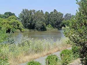
Napa River
| Napa River | |
| River | |
| Country | United States |
|---|---|
| State | California |
| Regions | Napa County, Solano County |
| Tributaries | |
| - left | Conn Creek, Rector Creek, Soda Creek, Milliken Creek, Suscol Creek |
| - right | Dry Creek, Napa Creek, Carneros Creek |
| City | Napa |
| Source | Mount Saint Helena |
| - location | Mayacamas Mountains |
| - elevation | 3,745 ft (1,141 m) |
| - coordinates | 38°39′52″N 122°37′14″W / 38.66444°N 122.62056°W |
| Mouth | Carquinez Strait |
| - location | San Pablo Bay |
| - elevation | 0 ft (0 m) |
| - coordinates | 38°4′12″N 122°14′38″W / 38.07000°N 122.24389°WCoordinates: 38°4′12″N 122°14′38″W / 38.07000°N 122.24389°W |
| Length | 55 mi (89 km) |
| Basin | 426 sq mi (1,103 km2) |
| Discharge | |
| - average | 210 cu ft/s (5.9 m3/s) |
| - max | 26,200 cu ft/s (741.9 m3/s) |
| - min | 0 cu ft/s (0.0 m3/s) |
The Napa River, approximately 55 miles (89 km) long, is a river in the U.S. state of California. It drains a famous wine-growing region, called the Napa Valley, in the mountains northeast of San Francisco. Milliken Creek and Mt. Veeder watersheds are a few of its many tributaries. The mouth is at Vallejo where the inter-tidal zone of fresh and salt waters flow into the Carquinez Straits on San Pablo Bay.
The Napa River rises in northwestern Napa County just south of the summit of Mt. St. Helena in the Mayacamas Mountains of the California Coast Ranges. The source begins as seasonal Kimball Canyon Creek in Robert Louis Stevenson State Park at an elevation of 3,745 feet (1,141 m) which descends the southern slope of Mt. St. Helena to Kimball Canyon Dam. It flows south for 4 miles (6 km), entering the head of the slender Napa Valley north of Calistoga. In the valley, it flows southeast past Calistoga, St Helena, Rutherford, Oakville and through Napa, its head of navigation. Downstream from Napa, it forms a tidal estuary, entering Mare Island Strait, a narrow channel on the north end of San Pablo Bay. It discharges into San Pablo Bay through the Napa Sonoma Marsh.
...
Wikipedia

