Nangan, Lienchiang
|
Nangan 南竿鄉 |
|
|---|---|
| Rural Township | |
| Nangan Township | |

Vegetable Farming Park
|
|
 Nangan Township in Lienchiang County |
|
| Location in the Republic of China | |
| Coordinates: 26°09′N 119°56′E / 26.150°N 119.933°ECoordinates: 26°09′N 119°56′E / 26.150°N 119.933°E | |
| Country | Republic of China |
| County | Lienchiang County |
| Area | |
| • Total | 10.40 km2 (4.02 sq mi) |
| Population (Dec. 2014) | |
| • Total | 7,496 |
| • Density | 720/km2 (1,900/sq mi) |
| Postal code | 209 |
| Area code(s) | (0)836 |
| Website | http://www.nankan.gov.tw/ |
| Nangan, Lienchiang | |||||||||||||
| Traditional Chinese | 南竿鄉 | ||||||||||||
|---|---|---|---|---|---|---|---|---|---|---|---|---|---|
| Simplified Chinese | 南竿乡 | ||||||||||||
|
|||||||||||||
| Transcriptions | |
|---|---|
| Standard Mandarin | |
| Hanyu Pinyin | Nángān Xiāng |
| Wade–Giles | Nan²-kan¹ Hsiang¹ |
| Eastern Min | |
| Fuzhou BUC | Nàng-găng-hiŏng |
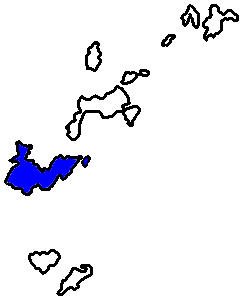
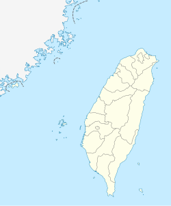
Nangan Township (Chinese: 南竿鄉) is a township in the Matsu Islands and the county seat of Lienchiang County, Taiwan.
Nangan was also known Nangantang (南竿塘; Nàng-găng-dòng) and Shanggantang (上竿塘). And because Lin Moniang's (who later became the goddess Matsu) corpse was washed ashore here, Nangan was also known as Matsu Island (馬祖島; Mā-cū-dō̤).
There is an airport in Nangan. The highest point is Yuntai Mountain (雲台山) (248-metre).
The island of Nangan is not only the largest island of its township, but also the largest island of Matsu. Nangan Township is also the largest township in Lienchiang County, with a population of about 4,000. The highest point of the island is the Yuntai Hill peak at 250m. Nangan's climate is classified as subtropical, with distinct seasons. The average year-round temperature is 20C, with July and August reaching 34C and January temperatures as low as 1.8C. There is an intense fog period during March and April which often affects the scheduled flights at Nangan Airport.
There are 10 villages located on Nangan. At the eastern end of the island is Jieshou (介壽村), the seat of the county government and the largest village. Following the coastal road west from Jieshou, there are Fuxing (復興村), Fuao (福澳村), Qingshui (清水村), Zhuluo (珠螺村) and Mazu (馬祖村). Following the mountain road west, there are Meishi (梅石村), Renai (仁愛村) and Jinsha (津沙聚落), before once again reaching Mazu. Located to the north of Mazu is Siwei (四維村). In addition to these, there are two smaller villages or clusters of homes. These are Furen (夫人村) and Ketiao (科蹄澳), they are located near Siwei.
Many villages on Nangan have two names. In some cases, this was the result of politics, as one is the traditional name and the second has a political connotation. These instances are paired as follows with the traditional name first: Shanlong (山隴): Jieshou (介壽), Niujiao (牛角(聚落)): Fuxing (復興), Tieban (鐵板): Renai (仁愛), and Fuao (福澳): Jingze (經澤). These names are often used interchangeably by residents, except for Jingze. Residents objected to this latter name, and so it never came into popular use. The reference to Shanlong is also important as there is a neighborhood there called Zhonglong (中隴). Mazu is also referred to as Magang (馬港) and Siwei as Xiwei (西尾). As for Mazu and Magang, Magang is the preferred name. This could be in order to distinguish the village and its harbor from Mazu (媽祖), the goddess, and Mazu (馬祖) the island chain. Xiwei was derived from the local Fuzhou dialect's pronunciation of Siwei.
...
Wikipedia

