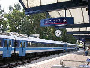
Nahariya Railway Station
|
Nahariya
נהריה |
|
|---|---|
 |
|
| Location | 2 HaGaaton Blvd, Nahariya Israel |
| Coordinates | 33°00′19″N 35°05′56″E / 33.00528°N 35.09889°ECoordinates: 33°00′19″N 35°05′56″E / 33.00528°N 35.09889°E |
| Platforms | 2 |
| Tracks | 3 |
| Connections | Central Bus Station |
| Construction | |
| Parking | 50 pay spaces |
| Bicycle facilities | 12 spaces |
| Disabled access | Yes |
| History | |
| Opened | 1945 |
| Rebuilt | 2001, 2013 |
Nahariya Railway Station (Hebrew: תחנת רכבת נהריה, Takhanat Rakevet Nahariya) is a railway station serving the city of Nahariya and the surrounding towns and villages of the Western Galilee region. It is the northern-most passenger station in Israel and is currently the terminus of the North-South coastal line.
The station is located on Ga'aton Boulevard (Hebrew: שדרות הגעתון, Sderot HaGe'aton), Nahariya's main street along the Ga'aton River, near the main entrance to the city from the coastal highway ( Highway 4) and across the street from the city's central bus station.
The first regular passenger service at the station began during the British Mandate of Palestine, on July 1, 1945. The station was then serving the Haifa – Beirut line. The service was then suspended during Israel's War of Independence (1947-1949), and resumed on June 1950 with 2 daily passenger trains to Haifa and back. This passenger service was again discontinued two years later but was finally reinstated in 1958. The railway connection to Beirut via Rosh HaNikra was never resumed after the end of the British Mandate.
...
Wikipedia
