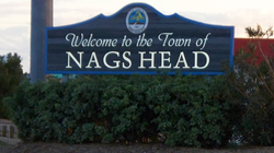
Nags Head
| Nags Head, North Carolina | |
|---|---|
| Town | |
 |
|
 Location in Dare County and the state of North Carolina. |
|
| Coordinates: 35°55′55″N 75°36′54″W / 35.93194°N 75.61500°WCoordinates: 35°55′55″N 75°36′54″W / 35.93194°N 75.61500°W | |
| Country | United States |
| State | North Carolina |
| County | Dare |
| Area | |
| • Total | 6.6 sq mi (17.2 km2) |
| • Land | 6.6 sq mi (17.0 km2) |
| • Water | 0.08 sq mi (0.2 km2) |
| Elevation | 3 ft (1 m) |
| Population (2010) | |
| • Total | 2,757 |
| • Density | 419/sq mi (161.7/km2) |
| Time zone | Eastern (EST) (UTC-5) |
| • Summer (DST) | EDT (UTC-4) |
| ZIP code | 27959 |
| Area code(s) | 252 |
| FIPS code | 37-45880 |
| GNIS feature ID | 1021599 |
| Website | townofnagshead |
Nags Head is a town in Dare County, North Carolina, United States. It is a busy vacation spot because of its beaches and sand dunes of Jockey's Ridge. The population was 2,757 at the 2010 census.
Early maps of the area show Nags Head as a promontory of land characterized by high sand dunes visible from miles at sea. The origin of the town's name is obscure, but it is likely to have been named after any one of the on the English coast.
A folkloric explanation claims that mules or horses () would have lights hung on their heads by nefarious wreckers in order to trick ships into running aground and then loot the ships of their valuables. The town's emblem depicts one such equine accomplice from the tale.
Around 1830, Nags Head became known as a resort area, and so remains today. Jockey's Ridge is the last vestige of the sand dunes seen by the first explorers, as the area is now highly developed. The town incorporated in 1961.
Nags Head is located at 35°55′55″N 75°36′54″W / 35.93194°N 75.61500°W (35.932004, -75.615085).
According to the United States Census Bureau, the town has a total area of 6.6 square miles (17.2 km2), of which 6.6 square miles (17.0 km2) is land and 0.1 square miles (0.2 km2), or 1.15%, is water.
As of the census of 2010, there were 2,757 people, 1,223 households, and 741 families residing in the town. The population density was 413.2 people per square mile (159.4/km²). There were 4,884 housing units at an average density of 634.9 per square mile (244.9/km²). The racial makeup of the town was 94.6% White, 1.6% African American, 0.15% Native American, 0.3% Asian, 1.4% from other races, and 1.5% from two or more races. Hispanic or Latino of any race were 1.44% of the population.
...
Wikipedia
