NASA Causeway
| NASA Causeway | |
|---|---|

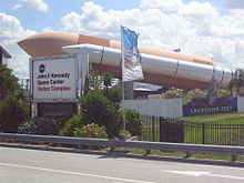
Visitors Complex from NASA Parkway
|
|
| Carries | State Road 405 |
| Locale | Brevard County, Florida |
NASA Parkway is an east-west roadway in Brevard County, Florida, frequently referred to by its easternmost section, the NASA Causeway, from which the general public viewed NASA manned space launches. Designated as part of State Road 405, the Parkway connects the Florida mainland to Merritt Island and onward — over the NASA Causeway — connects Merritt Island to Cape Canaveral. As such, the NASA Parkway is the main route connecting points of interest in Titusville, Florida to the Kennedy Space Center (on Merritt Island) to Cape Canaveral Air Force Station.
The portion of the parkway between U.S. Route 1 and State Road 3 is designated NASA Parkway West and also known as NASA Causeway West.
Although the designation of Florida State Route 405 begins further inland, the Parkway itself begins on the mainland when Columbia Boulevard crosses U.S. Route 1 in Titusville. Continuing eastward, NASA Parkway West crosses the Indian River Lagoon. A bascule bridge permits boats on the Intracoastal Waterway to pass through the causeway. Continuing eastward, approximately 2 miles (3.2 km), it enters the Merritt Island National Wildlife Refuge and the John F. Kennedy Space Center near its intersection with Space Commerce Way (also known as Government Road). At this point, the Merritt Island peninsula is at its widest and about 6 miles (9.7 km) wide, permitting the Parkway to make maximum use of land sections in reaching Cape Canaveral.
...
Wikipedia
