Myinmu
|
Myinmu မြင်းမူ |
|
|---|---|
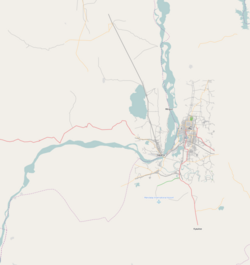
| Location in the Sagaing area and in relation to the Irrawaddy River. | |
| Coordinates: 21°56′N 95°35′E / 21.933°N 95.583°ECoordinates: 21°56′N 95°35′E / 21.933°N 95.583°E | |
| Country |
|
| Region | Sagaing Region |
| District | Sagaing District |
| Township | Myinmu Township |
| Time zone | MST (UTC+6.30) |
Myinmu (Burmese: မြင်းမူ) is a river town in the south-east of the Sagaing Division in Burma. The town has a rich history linked to World War II during the Burma Campaign against the Japanese, in 1944. It was also under the control of the Portuguese Missionaries in the 19th century. One of the first agricultural cooperatives was established here in 1905.
Myinmu is the principal town of Myinmu Township and the town lies on the northern bank of the Irrawaddy River. Mu River flows about 7.5 kilometres (4.7 mi) away from the town. The population within 7 kilometres (4.3 mi) radius of the town is reported to be 19,452. It is located roughly 35 kilometres (22 mi) west of Mandalay. The nearest settlements are Paledan to the east and Tizaung, about 2 miles (3.2 km) to the north-east. Other settlements of note in the vicinity are Allagappa to the west and Ngaizun, located several miles away on the opposite side of the river.
The nearest International Airport is Mandalay International Airport (MDL), which is 69.7 kilometres (43.3 mi) away from the town.
In Myinmu was recorded the highest temperature ever in Burma of 47 °C.
Myinmu was occupied by Portuguese missionaries in the late 19th century who established Roman Catholic Mission in Myinmu and opened stations at Nabet and Chaung-U.
One of the earliest cooperatives in Burma was established in Myinmu township in March 1905 with 19 members. Myinmu was occupied by the British Indian Army during the Burma Campaign against the Japanese in 1944.Douglas Gracey occupied Myinmu on February 13, 1944 and crossed the Irrawaddy.
...
Wikipedia

