Muthi Muthi people
| Muthi Muthi | |
|---|---|
| aka: Muthimuthi, Muti Muti, Mutte Mutte, Matimati, Madi-madi, Mataua, Moorta, Matthee-matthee, Bakiin (by southern tribes), Madi Madi and Madhi Madhi (AIATSIS), nd (SIL) | |

|
|
| Hierarchy | |
| Language family: | Pama–Nyungan |
| Language branch: | Kulin |
| Language group: | Western |
| Group dialects: | Madhi Madhi |
| Area | |
| Location: | Northern Riverina and Far West regions of New South Wales |
| Coordinates: | 33°30′S 145°30′E / 33.500°S 145.500°E |
| Rivers | |
| Lakes | |
| Urban areas | |
| Notable individuals | |
The Muthi Muthi people are an Aboriginal group of the Kulin Nation whose traditional lands are located in the Northern Riverina and Far West regions of New South Wales. Clans of the Muthi Muthi include the Yita Yita, Kunji Kunji, Tati Tati and Berriat (Parindji).
The Muthi Muthi are the traditional owners of Nimmie Caira and the Lowbidgee as well as the Willandra Lakes, Lake Mungo and the Lake Mungo remains (which are co-owned by the neighbouring Paarkinji and Nyiampaar tribes).
The Muthimuthi endonym is form from their word for 'mouth', namely mut/muth, meaning 'tongue or speech.'
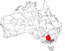
Muthi Muthi territory covered an estimated 2,200 sq. miles of land, with a southeastern boundary beneath Balranald across the Murrumbidgee River, where its borders ran down to the northern boundaries of the Watiwati. To the southwest they touched the Murray River. To the west, their boundaries approached the areas of Lake Benanee and at Reedy Lake, and ran from north to west of Carrawathal. The Muthimuthi tribal lands were a meeting place for many indigenous groups for ceremonies and marriages. The Muthi Muthi lands are often referred to as the "Five Rivers Region" of Australia. The rivers are the Lachlan, Murray, Murrumbidgee, Edward and Wakool.
Neighbouring tribal boundaries are the Barindji to the west roughly along the line of the Willandra Lakes to Mount Dispersion; the Ngyiampaar/Ngemba to the north above Willandra Creek, and the Wemba-Wemba/Barabarapa on the south side of the Murray River. The Nari Nari/Wathi Wathi boundary to the east has not been formally marked out but the Nari Nari Tribal Council refer to Dry Lake [near Tchelery] as being the western most reach of their lands. Archaeological investigation has confirmed a tribal boundary in this location as this is the last known location of Muthi Muthi burial mounds.
...
Wikipedia
