Murgon
|
Murgon Queensland |
|||||||||||||
|---|---|---|---|---|---|---|---|---|---|---|---|---|---|

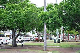
The park on the main street of Murgon
|
|||||||||||||
|
The location of Murgon in Queensland
|
|||||||||||||
| Coordinates | 26°14′0″S 151°57′0″E / 26.23333°S 151.95000°ECoordinates: 26°14′0″S 151°57′0″E / 26.23333°S 151.95000°E | ||||||||||||
| Population | 2,092 (2011 census) | ||||||||||||
| Postcode(s) | 4605 | ||||||||||||
| Location | |||||||||||||
| LGA(s) | South Burnett Region | ||||||||||||
| State electorate(s) | Callide | ||||||||||||
| Federal Division(s) | Wide Bay | ||||||||||||
|
|||||||||||||
Murgon is a town and locality in the South Burnett Region, Queensland, Australia. It is situated on the Bunya Highway 270 kilometres (170 mi) north-west of the state capital, Brisbane. At the 2011 Australian Census the town recorded a population of 2,092.
Murgon is in the region of Queensland known as the South Burnett, the southern part of the Burnett River catchment. Attractions of Murgon include winemaking, fishing on the nearby Bjelke-Petersen Dam and gem-fossicking. Industries include peanuts, dairy farming, beef and cattle production and wine. The Indigenous Australian settlement of Cherbourg is just south of Murgon.
Murgon Post Office opened by June 1908 (a receiving office had been open from 1904).
The foundation stone of the Murgon War Memorial was laid on 25 April 1920 (ANZAC Day) by Lieutenant Colonel Wilder Neligan. On 11 November 1921, the digger memorial was dedicated by RSL chairman, Major General Spencer Browne.
In the early 20th century the Nanango railway line reached the town. The town was the administrative centre for the former Shire of Murgon which existed from 1914 until 2008.
...
Wikipedia

