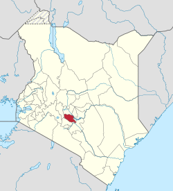
Murang'a County
| Murang'a County | ||
|---|---|---|
| County | ||

Murang’a County Landscape
|
||
|
||
 Location in Kenya |
||
| Country |
|
|
| Formed | March 4th 2013 | |
| Capital | Murang'a | |
| Area | ||
| • Total | 2,325.8 km2 (898.0 sq mi) | |
| Population (2009) | ||
| • Total | 942,581 | |
| Time zone | EAT (UTC+3) | |
| Website | Murang’a.go.ke | |
Murang'a County is one of the counties of Kenya's former Central Province. Its largest town is Murang'a its capital, called Fort Hall in colonial times (before 1963). It is inhabited mainly by and is considered the home of the Gikuyu, the largest community in Kenya. The county has a population of 942,581 (2009 census). Many have traveled to Murang’a to enjoy the lush foliage (www.planning.go.ke). On the road to the post office the road forks leading traveler to take the road to Nyeri via Kiria-ini and beyond or the road to the Murang’a Technical College. As the traveler walks along the road, an old English pub sits along the road on the right. Over the course of several years Murang’a became a site for placement of Peace Corps volunteers (www.peacecorps.com)
When missionaries first came to Kenya, they were prevented from settling on the coast by the Portuguese, who had taken the coastal area, strategic for trade, from Arab powers in the 16th century. The missionaries were forced to venture into Kenya's rugged interior and Murang'a was one of the first places they settled.
When the British set up the East African Protectorate in 1895, their first administrative post (Fort Smith) was located in Murang'a.
One of the main highlights of Murang'a's history, however, is that the Mau Mau uprising that was led by the Agikuyu community who consider Murang'a their ancestral origin. Murang'a is thus considered by some as the birthplace of the Kenyan independence movement. Missionaries had initially been welcomed by Karuri Wagakure who was the chief of Tuthu. They set up the first mission church in Kenya at Murang'a. Murang'a is also the source of many big rivers like River Maragua which originates from the heart of the Aberdare range, River Mathioya, River Kayahwe, River Irati, River Muriurio and many others. Murang'a is additionally known for its fertile farming soil and good climate with maize, beans, sweet potatoes, arrow roots, pumpkins,bananas and numerous other food crops grown in the region. Tea and Coffee are the main cash crops produced.
The Constitution of Kenya of 2010 created 47 regional governments with the formerly larger Murang'a district as a county. The county government is composed of an executive branch and an assembly.
...
Wikipedia

