Muqeible
|
Muqeible מֻקֵיבִּלָה مقيبلة |
|
|---|---|
| Coordinates: 32°30′51″N 35°17′41″E / 32.51417°N 35.29472°ECoordinates: 32°30′51″N 35°17′41″E / 32.51417°N 35.29472°E | |
| Grid position | 177/213 PAL |
| District | Northern |
| Council | Gilboa |
| Population (2015) | 3,719 |
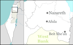
Muqeible or Muqeibla (Arabic: مقيبلة, Hebrew: מֻקֵיבִּלָה), meaning "The front place", is an Arab town in Israel's Northern District, situated in the Jezreel Valley between Jenin in the West Bank and the Ta'anakh area. It is a part of the Gilboa Regional Council.In 2015 its population was 3,719. The inhabitants are Muslims and Christians.
During the Roman-era, a town called "Muqeibleh" stood at the site. Byzantine-era settlement is attested to archaeologically by a well and pottery workshops from that period near the present village.
According to a local inhabitant, the villagers moved here from the al-Haram-Sidna Ali-area in the latter part of the Ottoman period. In 1838 Edward Robinson noted Mukeibileh as a “village in the plain, on the direct route from Jenin to Nazareth.” He placed Mukeibileh as being in the District of Jenin, also called "Haritheh esh-Shemaliyeh".
Victor Guérin, who visited in 1870, noted that the village contained 400 inhabitants and had a number of cisterns. In 1882, the Palestine Exploration Fund's Survey of Western Palestine described Muqeible as "a mud village in the plain, supplied by cisterns."
...
Wikipedia

