Muncy, Pennsylvania
| Muncy, Pennsylvania | ||
|---|---|---|
| Borough | ||

Downtown Muncy
|
||
|
||
 Map of Lycoming County, Pennsylvania highlighting Muncy |
||
 Map of Pennsylvania highlighting Lycoming County |
||
| Coordinates: 41°12′7″N 76°47′11″W / 41.20194°N 76.78639°WCoordinates: 41°12′7″N 76°47′11″W / 41.20194°N 76.78639°W | ||
| Country | United States | |
| State | Pennsylvania | |
| County | Lycoming | |
| Settled | 1797 | |
| Incorporated | 1826 | |
| Government | ||
| • Mayor | Jon Ort | |
| Area | ||
| • Total | 0.8 sq mi (2.2 km2) | |
| • Land | 0.8 sq mi (2.2 km2) | |
| • Water | 0.0 sq mi (0.0 km2) | |
| Elevation | 499 ft (152 m) | |
| Population (2000) | ||
| • Total | 2,663 | |
| • Density | 3,174.3/sq mi (1,225.6/km2) | |
| Time zone | Eastern (EST) (UTC-5) | |
| • Summer (DST) | EDT (UTC-4) | |
| ZIP code | 17756 | |
| Area code(s) | 570 Exchange: 546 | |
| FIPS code | 42-52264 | |
| GNIS feature ID | 1213993 | |
| Website | Muncy Borough | |
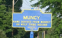
Muncy is a borough in Lycoming County, Pennsylvania, United States. The name Muncy comes from the Munsee Indians who once lived in the area. The population was 2,663 at the 2000 census. It is part of the Williamsport, Pennsylvania Metropolitan Statistical Area. Muncy is located on the West Branch Susquehanna River, just south of the confluence of Muncy Creek with the river.
About 1787, four brothers Silas, William, Benjamin, and Isaac McCarty, came here from Bucks County. They were of Quaker extraction. William and Benjamin bought 300 acres (120 ha) known as the "John Brady farm."
John Brady was one of the earliest settlers in the area. He received a land grant which was awarded to the officers who served in the Bouquet Expedition. He chose land west of present-day Lewisburg, Pennsylvania. He built a private stockade on this land in the Spring of 1776, close to present day Muncy, Pennsylvania, which he called "Fort Brady." John Brady's Muncy house was large for its day. He dug a 4-foot-deep (1.2 m) trench around it and emplaced upright logs in that trench side by side all the way around. He filled the trench with dirt and packed the dirt against the logs to hold the log wall solidly in place. This log wall ran about twelve feet high from the ground. He then held this wall in place upright by pinning smaller logs across its top, to keep the wall face steady and solid. The John Brady homestead was perilously close to the leading edge of the frontier of that time, the Susquehanna River. The other side of the Susquehanna was fiercely dominated by the Indians. The Indians resisted settler encroachment on their territory by routinely crossing the Susquehanna to raid the settlers. The settlers just as routinely crossed the Susquehanna to pursue the raiding war parties to retaliate and sometimes to rescue captives taken by the Indians during these raids. In this ongoing skirmishing, both sides committed unspeakable atrocities on the other, which drove a long-lasting cycle of revenge for revenge brutalities between the settlers and Indians. It was in the midst of this extreme danger and violence that Major John Brady chose to settle his family, which set the stage for what happened to him and for what so greatly impacted and influenced his family—especially, his sons, Continental Army Captain Samuel Brady of Brady's Leap fame and Hugh Brady, who became a Major General in the United States Army.
...
Wikipedia

