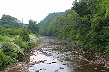
Muncy Creek
| Muncy Creek | |
|---|---|

Muncy Creek looking upstream in Picture Rocks
|
|
| Native name | Occohpocheny |
| Basin features | |
| Main source | southeastern Laporte Township, Sullivan County, Pennsylvania 2,260 to 2,280 feet (688.8 to 694.9 m) |
| River mouth | West Branch Susquehanna River in Muncy Creek Township, Lycoming County, Pennsylvania slightly less than 480 feet (150 m) 41°12′35″N 76°48′12″W / 41.2098°N 76.8033°WCoordinates: 41°12′35″N 76°48′12″W / 41.2098°N 76.8033°W |
| Basin size | 216 sq mi (560 km2) |
| Tributaries |
|
| Physical characteristics | |
| Length | 35.8 mi (57.6 km) |
| Discharge |
|
Muncy Creek (also known as Big Muncy Creek) is a tributary of the West Branch Susquehanna River in Sullivan County and Lycoming County, in Pennsylvania, in the United States. It is approximately 34.5 miles (55.5 km) long. The watershed of the creek has an area of 216 square miles (560 km2). The creek's discharge averages 49 cubic feet per second (1.4 m3/s) at Sonestown, but can be up to a thousand times higher at Muncy. The headwaters of the creek are on the Allegheny Plateau. Rock formations in the watershed include the Chemung Formation and the Catskill Formation.
There are a number of lakes in the watershed of Muncy Creek, including Eagles Mere Lake, Highland Lake, and Beaver Lake. The creek was known as Occohpocheny to Native Americans. The area in its vicinity was settled in 1783. Various other industries and mills were constructed in the creek's vicinity from the late 18th century to the early 20th century. Wild trout naturally reproduce in part of Muncy Creek. Part of the creek is navigable by canoe.
Muncy Creek begins in southeastern Laporte Township, Sullivan County, near its border with Davidson Township, Sullivan County. The creek flows southwest and then west for a short distance before reaching the border between Laporte Township and Davidson Township. It then turns southwest as it begins to follow this border. Shortly afterwards it turns northwest and begins to flow into a valley, then turns west and begins receiving very short tributaries from both sides. Examples of these include Rock Run and Lopez Pond Branch. After picking up Peters Creek, one such tributary, Muncy Creek turns southwest and passes the community of Nordmont, where the tributary Elklick Run flows into it. The creek then turns southwest and later west. Deep Hollow Run then enters the creek, which heads south away from the Laporte Township/Davidson Township border. Upon leaving behind the Laporte Township/Davidson Township border, the creek enters Davidson Township and heads west-southwest, passing a gauging station. After several miles, it reaches the community of Sonestown, where the tributary Big Run flows into it from the north. Muncy Creek then makes a sharp bend south and begins flowing parallel to U.S. Route 220. After a few miles, it passes the community of Muncy Valley and makes a sharp turn south, exiting Davidson Township.
...
Wikipedia
