Mulvane, Kansas
| Mulvane, Kansas | |
|---|---|
| City | |
 Location within Sedgwick County and Kansas |
|
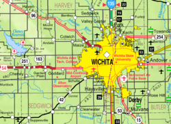
 KDOT map of Sedgwick County (legend) |
|
| Coordinates: 37°28′47″N 97°14′32″W / 37.47972°N 97.24222°WCoordinates: 37°28′47″N 97°14′32″W / 37.47972°N 97.24222°W | |
| Country | United States |
| State | Kansas |
| Counties | Sedgwick, Sumner |
| Incorporated | 1883 |
| Government | |
| • Mayor | Shelly Steadman |
| Area | |
| • Total | 4.52 sq mi (11.71 km2) |
| • Land | 4.50 sq mi (11.65 km2) |
| • Water | 0.02 sq mi (0.05 km2) |
| Elevation | 1,234 ft (376 m) |
| Population (2010) | |
| • Total | 6,111 |
| • Estimate (2015) | 6,314 |
| • Density | 1,400/sq mi (520/km2) |
| Time zone | Central (CST) (UTC-6) |
| • Summer (DST) | CDT (UTC-5) |
| ZIP code | 67110 |
| Area code | 316 |
| FIPS code | 20-49100 |
| GNIS feature ID | 0470229 |
| Website | mulvanekansas.com |
Mulvane is a city in Sedgwick and Sumner counties in the U.S. state of Kansas. As of the 2010 census, the city population was 6,111.
Mulvane was laid out in 1879 at the junction of five Santa Fe rail lines. It is named for Joab R. Mulvane, a railroad official who was instrumental in bringing the Atchison, Topeka, and Santa Fe Railroad to Mulvane.
Mulvane's Main Street follows part of the Sedgwick and Sumner county lines, and the town center is about five miles west of the spot where Sedgwick, Sumner, Butler and Cowley counties meet.
Mulvane is also home of the Patriot Guard Riders. The Patriot Guard was established in Mulvane, Kansas at American Legion Post 136 in 2005. The founding members incorporated the organization as a 501(c)(3) non-profit in the State of Oklahoma on February 21, 2006.
Mulvane is located at 37°28′47″N 97°14′32″W / 37.47972°N 97.24222°W (37.479746, -97.242309). According to the United States Census Bureau, the city has a total area of 4.52 square miles (11.71 km2), of which, 4.50 square miles (11.65 km2) is land and 0.02 square miles (0.05 km2) is water.
Mulvane is part of the Wichita, KS Metropolitan Statistical Area.
As of the census of 2010, there were 6,111 people, 2,244 households, and 1,661 families residing in the city. The population density was 1,358.0 inhabitants per square mile (524.3/km2). There were 2,357 housing units at an average density of 523.8 per square mile (202.2/km2). The racial makeup of the city was 94.4% White, 0.6% African American, 1.1% Native American, 0.8% Asian, 0.1% Pacific Islander, 0.7% from other races, and 2.4% from two or more races. Hispanic or Latino of any race were 3.5% of the population.
...
Wikipedia
