Mt Cook
| Aoraki / Mount Cook | |
|---|---|

Aoraki / Mount Cook from Hooker Lake
|
|
| Highest point | |
| Elevation | 3,724 m (12,218 ft) |
| Prominence | 3,724 m (12,218 ft) Ranked 39th |
| Isolation | 3,140 kilometres (1,950 mi) |
| Listing |
Country high point Ultra |
| Coordinates | 43°35′42.2″S 170°8′31.7″E / 43.595056°S 170.142139°ECoordinates: 43°35′42.2″S 170°8′31.7″E / 43.595056°S 170.142139°E |
| Geography | |
|
South Island, New Zealand
|
|
| Parent range | Southern Alps |
| Climbing | |
| First ascent | 1894 by Tom Fyfe, George Graham, Jack Clarke |
| Easiest route | glacier/snow/ice climb |
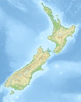
Aoraki / Mount Cook is the highest mountain in New Zealand. Its height since 2014 is listed as 3,724 metres (12,218 feet), down from 3,764 m (12,349 ft) before December 1991, due to a rockslide and subsequent erosion. It lies in the Southern Alps, the mountain range which runs the length of the South Island. A popular tourist destination, it is also a favourite challenge for mountain climbers. Aoraki / Mount Cook consists of three summits, from South to North the Low Peak (3,593 m or 11,788 ft), Middle Peak (3,717 m or 12,195 ft) and High Peak. The summits lie slightly south and east of the main divide of the Southern Alps, with the Tasman Glacier to the east and the Hooker Glacier to the southwest.
There was a large rock fall in 1991 that turned the summit into a knife-edge ridge and reduced the height of the mountain by an estimated 10 m or so at that time. A/MC was measured in 2013 to be 3724 m, which is 30 m down from its pre-1991 rock-fall measurement.
The mountain is in the Aoraki/Mount Cook National Park, in the Canterbury region. The park was established in 1953 and along with Westland National Park, Mount Aspiring National Park and Fiordland National Park forms one of the UNESCO World Heritage Sites. The park contains more than 140 peaks standing over 2,000 metres (6,600 ft) and 72 named glaciers, which cover 40 percent of its 700 square kilometres (170,000 acres).
The peak is located at the northern end of the Kirikirikatata / Mount Cook Range, where it meets with the main spine of the Main Divide, forming a massif between the Hooker Valley to the southwest and the Tasman Valley east of the mountain. These two valleys provide the closest easily accessible view points of Aoraki / Mount Cook. A lookout point at the end of the Hooker Valley Track located only 10 km from the peak offers spectacular views of the entire mountainside.
...
Wikipedia

