Mt. Vernon, Ohio
| Mount Vernon, Ohio | |
|---|---|
| City | |

East High Street Historic District, Mount Vernon
|
|
| Motto: "One of Ohio's Most Likable Communities" | |
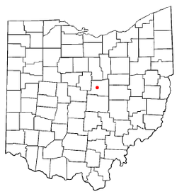
 Location of Mount Vernon, Ohio |
|
 Location of Mount Vernon in Knox County |
|
| Coordinates: 40°23′34″N 82°28′52″W / 40.39278°N 82.48111°WCoordinates: 40°23′34″N 82°28′52″W / 40.39278°N 82.48111°W | |
| Country | United States |
| State | Ohio |
| County | Knox |
| Government | |
| • Mayor | Richard K. Mavis |
| Area | |
| • Total | 9.60 sq mi (24.86 km2) |
| • Land | 9.41 sq mi (24.37 km2) |
| • Water | 0.19 sq mi (0.49 km2) |
| Elevation | 1,001 ft (305 m) |
| Population (2010) | |
| • Total | 16,990 |
| • Estimate (2012) | 16,812 |
| • Density | 1,805.5/sq mi (697.1/km2) |
| Time zone | Eastern (EST) (UTC-5) |
| • Summer (DST) | EDT (UTC-4) |
| ZIP code | 43050 |
| Area code(s) | 740 |
| FIPS code | 39-53102 |
| GNIS feature ID | 1056436 |
| Website | http://www.mountvernonohio.org/ |
Mount Vernon is a city in Knox County, Ohio, United States. The population was 16,990 at the 2010 census. It is the county seat of Knox County.
The community was platted in 1805, and named after Mount Vernon, the plantation owned by George Washington.
On January 1959 a severe flood caused 500 homes to be evacuated and caused $5 million in damage. In August 2006, an F0 tornado touched down on the west side of town. It demolished a barn at the local 84 Lumber, and the resulting debris blew across the road to the DeCosky GM car dealership. It caused at least $150,000 of damage.
The Woodward Opera House, the oldest opera theater of its kind in the United States, is located downtown. The theater is currently under major renovation and will, upon its completion, be transformed into a local cultural and performing-arts center.
The Knox County Historical Society, with a building and extensive exhibits, makes its headquarters on Harcourt Road in Mount Vernon. Exhibits feature information about Daniel Decatur Emmett, Paul Lynde, The Cooper Company and other subjects.
Mount Vernon is located at 40°23′34″N 82°28′52″W / 40.39278°N 82.48111°W (40.392738, −82.481151).
According to the United States Census Bureau, the city has a total area of 9.60 square miles (24.86 km2), of which 9.41 square miles (24.37 km2) is land and 0.19 square miles (0.49 km2) is water. The city lies in the Glaciated Allegheny Plateau and is surrounded by rolling hills and valleys.
...
Wikipedia
