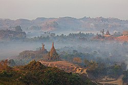
Mrauk U
|
Mrauk U မြောက်ဦးမြို့ |
|
|---|---|

Mrauk U from Shwetaung pagoda
|
|
 Map of Mrauk U with main temples |
|
| Location in Myanmar (Burma) | |
| Coordinates: 20°35′45.90″N 93°11′38.58″E / 20.5960833°N 93.1940500°ECoordinates: 20°35′45.90″N 93°11′38.58″E / 20.5960833°N 93.1940500°E | |
| Country |
|
| Division | Rakhine State |
| District | Mrauk-U District |
| Township | Mrauk-U Township |
| Settled | 16 November 1430 |
| Population (2014 census) | 189,630 |
| • Ethnicities | Rakhine |
| • Religions | Theravada Buddhism |
| Time zone | MMT (UTC+6.30) |
Mrauk U (Burmese: မြောက်ဦးမြို့; MLCTS: mrauk u: mrui., Burmese pronunciation: [mjaʊʔ ú mjo̰]; formerly known as Myohaung) is an archaeologically important town in northern Rakhine State, Myanmar. It is also the capital of Mrauk-U Township, a sub region of the Mrauk-U District. From 1430 until 1785, it was the capital of the Mrauk U Kingdom, the most important and powerful Rakhine (Arakanese) kingdom.
Mrauk U lies roughly 11 kilometres (6.8 mi) east of the Kaladan River on the banks of its minor tributaries. The town is located on a small outcrop of the Rakhine Yoma on the eastern side of the Kaladan's alluvial plain. Thus, the surrounding countryside is hilly yet also contains a great deal of marshes, mangroves and lakes.
Mrauk U, like much of Rakhine State, is situated in a coastal tropical monsoon rainforest climate region. The town receives over 1,200 millimetres (47 in) of rain a year from the Southwestern Monsoon, making it one of the wettest regions in Myanmar. The Monsoon season usually begins in late May and ends by mid October.
Although located in a tropical region, Mrauk U enjoys lower temperatures when the Northeastern Monsoon falls. From mid October to mid March during the Cool Season, temperatures can drop to 13 °C (55 °F). This season coincides with the tourist season for Myanmar.
The rainfall on 19 July 2011 was nearly 24 centimetres (9.4 in), the highest for 33 years. There was flood because of continuous heavy rains in July 2011.
...
Wikipedia

