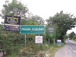
Moycullen
|
Maigh Cuilinn Moycullen |
|
|---|---|
| Village | |

Signs outside Moycullen village
|
|
| Location in Ireland | |
| Coordinates: 53°20′21″N 9°10′50″W / 53.3391°N 9.18042°WCoordinates: 53°20′21″N 9°10′50″W / 53.3391°N 9.18042°W | |
| Country | Ireland |
| Province | Connacht |
| County | County Galway |
| Elevation | 86 m (282 ft) |
| Population (2011) | |
| • Urban | 1,559 |
| Irish Grid Reference | M198329 |
| As this is a Gaeltacht village, the Irish Maigh Cuilinn is the only official name. The anglicized spelling Moycullen has no official standing. | |
Moycullen (Irish: Maigh Cuilinn) is a Gaeltacht village in County Galway, Ireland, about 10 km (7 mi) northwest of Galway city. It is near Lough Corrib, on the N59 road to Oughterard and Clifden, in Connemara. Moycullen is now a satellite town of Galway with most residents commuting to the city for work, school, and business.
There is a primary school in the village, Scoil Mhuire, and three other primary schools in the parish: Scoil Naomh Bríde in Tullykyne, Scoil Bhaile Nua in Newtown, and Scoil Naomh Cholmáin in Tooreeny.
It is home to two senior GAA clubs, a handball club and a basketball club.
Most townlands are anglisations of the original Irish-language names.
...
Wikipedia

