Mount Macedon
| Mount Macedon | |
|---|---|
| Geboor or Geburrh | |

Mount Macedon, above the town of Mount Macedon.
|
|
| Highest point | |
| Elevation | 1,001 metres (3,284 ft) AHD |
| Prominence | 643 metres (2,110 ft) AHD |
| Parent peak | Camel's Hump or Camels Hump |
| Coordinates | 37°22′59″S 144°34′35″E / 37.38306°S 144.57639°ECoordinates: 37°22′59″S 144°34′35″E / 37.38306°S 144.57639°E |
| Geography | |
|
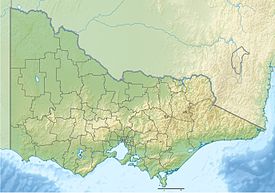
Location in Victoria
|
|
| Location | Central Highlands, Victoria, Australia |
| Parent range | Macedon Ranges, Great Dividing Range |
| Climbing | |
| First ascent | Thomas Mitchell (European: 1836) |
Mount Macedon /maʊnt ˈmæsədən/ (Aboriginal Woiwurrung language: Geboor or Geburrh) is a mountain that is part of the Macedon Ranges of the Great Dividing Range, located in the Central Highlands region of Victoria, Australia. The mountain has an elevation of 1,001 metres (3,284 ft) AHD with a prominence of 643 metres (2,110 ft) AHD and is located approximately 65 kilometres (40 mi) northwest of Melbourne.
The mountain is known as Geboor or Geburrh in the Aboriginal Woiwurrung language of the Wurundjeri people.
The mountain was originally sighted by Hamilton Hume and William Hovell on their 1824 expedition to Port Phillip from New South Wales. They named it Mount Wentworth. It was renamed Mount Macedon by explorer Major Thomas Mitchell who ascended the mountain in 1836. He named it after Philip of Macedon in honour of the fact that he was able to view Port Philip from the summit. Several other geographic features along the path of his third Australia Felix expedition were named after figures of Ancient Macedonia including the nearby Campaspe River and Mount Alexander near Castlemaine (named after Alexander the Great).
...
Wikipedia

