Mount Gilead, OH
| Mount Gilead, Ohio | |
|---|---|
| Village | |

|
|
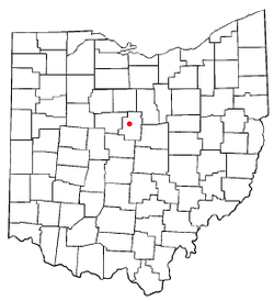
 Location of Mount Gilead, Ohio |
|
 Location of Mount Gilead in Morrow County |
|
| Coordinates: 40°33′8″N 82°49′54″W / 40.55222°N 82.83167°WCoordinates: 40°33′8″N 82°49′54″W / 40.55222°N 82.83167°W | |
| Country | United States |
| State | Ohio |
| County | Morrow |
| Government | |
| • Mayor | Mike Porter |
| Area | |
| • Total | 3.40 sq mi (8.81 km2) |
| • Land | 3.39 sq mi (8.78 km2) |
| • Water | 0.01 sq mi (0.03 km2) |
| Elevation | 1,135 ft (346 m) |
| Population (2010) | |
| • Total | 3,660 |
| • Estimate (2012) | 3,658 |
| • Density | 1,079.6/sq mi (416.8/km2) |
| Time zone | Eastern (EST) (UTC-5) |
| • Summer (DST) | EDT (UTC-4) |
| ZIP code | 43338 |
| Area code(s) | 419 |
| FIPS code | 39-52738 |
| GNIS feature ID | 1065069 |
| Website | http://www.mountgilead.net/ |
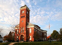
Mount Gilead is a village in Morrow County, Ohio, United States.
The population was 3,660 at the 2010 census. It is the county seat of Morrow County and the center of population of Ohio. The village was established in 1832, eight years after white settlers arrived in the region. Before their arrival, the forest was a hunting area for the Shawnee tribe.
Located in the center of the village is Morrow County's historic World War I Victory Memorial Shaft, unique in the United States, and Mount Gilead State Park is nearby on State Route 95. Other areas drawing tourism include the Amish farms, shops and stores east of Mount Gilead, near Chesterville and Johnsville. Mount Gilead is also home to the Morrow County Hospital.
The first settler to make Mount Gilead (Mt. Gilead) home was Lewis Hardenbrook, in 1817, though it was then called Whetstone and was located in Marion County. In 1824, Judge Jacob Young drew out the village; the plan consisting of 80 lots and also included a public square. Several years later, in 1832, Henry Ustick added an additional 70 lots to the village as well as an additional public square. The original public square was then referred to as the south square and the newer square, the north square. Many years later, in 1919, the north public square would become home to the Victory Shaft World War I Monument. This monument was given to the county for having the highest per capita war bond sales during a two-year period. Charles Webster built the first cabin in the village in December 1824. He served as the first Postmaster and operated the Post Office from the cabin, as well. In 1832, a measure was proposed to change the name of the town. Residents were asked to vote between the names Warsaw and Mt. Gilead. Mt. Gilead was chosen by a significant margin and the village was incorporated by state legislature several years later in 1839.
...
Wikipedia
