Mount Eaton, Ohio
| Mount Eaton, Ohio | |
|---|---|
| Village | |

Central Mount Eaton
|
|
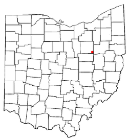
 Location of Mount Eaton, Ohio |
|
 Location of Mount Eaton in Wayne County |
|
| Coordinates: 40°41′43″N 81°42′11″W / 40.69528°N 81.70306°WCoordinates: 40°41′43″N 81°42′11″W / 40.69528°N 81.70306°W | |
| Country | United States |
| State | Ohio |
| County | Wayne |
| Area | |
| • Total | 0.18 sq mi (0.47 km2) |
| • Land | 0.18 sq mi (0.47 km2) |
| • Water | 0 sq mi (0 km2) |
| Elevation | 1,250 ft (381 m) |
| Population (2010) | |
| • Total | 241 |
| • Estimate (2012) | 241 |
| • Density | 1,338.9/sq mi (517.0/km2) |
| Time zone | Eastern (EST) (UTC-5) |
| • Summer (DST) | EDT (UTC-4) |
| ZIP code | 44659 |
| Area code(s) | 330 |
| FIPS code | 39-52682 |
| GNIS feature ID | 1065067 |
Mount Eaton is a village in Wayne County, Ohio, United States. The population was 241 at the 2010 census.
Mount Eaton was platted in 1814.
Located near Mount Eaton is the historic James Akey Farm, also known as the "Stark Wilderness Center Pioneer Farm"; it is listed on the National Register of Historic Places. It was once a mining town and is built above many mines. A man was mowing his yard and his mower fell in a hole, which turned out to be an old mine.
Mount Eaton is located at 40°41′43″N 81°42′11″W / 40.69528°N 81.70306°W (40.695200, -81.703132).
According to the United States Census Bureau, the village has a total area of 0.18 square miles (0.47 km2), all of it land.
85.0% spoke English, 10.0% Dutch, and 5.0% Pennsylvania Dutch as their first language.
As of the census of 2010, there were 241 people, 93 households, and 62 families residing in the village. The population density was 1,338.9 inhabitants per square mile (517.0/km2). There were 103 housing units at an average density of 572.2 per square mile (220.9/km2). The racial makeup of the village was 98.8% White, 0.4% from other races, and 0.8% from two or more races. Hispanic or Latino of any race were 0.4% of the population.
...
Wikipedia
