Mount Chiquita
| Mount Chiquita | |
|---|---|

Mounts Ypsilon (left of center), Chiquita (center), and Chapin (right)
|
|
| Highest point | |
| Elevation | 13,075 ft (3,985 m) |
| Prominence | 283 ft (86 m) |
| Isolation | 0.99 mi (1.59 km) |
| Coordinates | 40°26′38″N 105°41′20″W / 40.4438726°N 105.6888938°WCoordinates: 40°26′38″N 105°41′20″W / 40.4438726°N 105.6888938°W |
| Geography | |
|
|
|
| Location | Rocky Mountain National Park, Larimer County, Colorado, U.S. |
| Parent range | Mummy Range |
| Topo map |
USGS 7.5' topographic map Trail Ridge, Colorado |
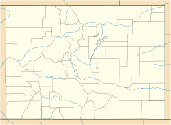
Mount Chiquita is a mountain summit in the Mummy Range of the Rocky Mountains of North America. The 13,075-foot (3,985 m) thirteener is located in Rocky Mountain National Park, 9.8 miles (15.7 km) northwest by west (bearing 298°) of the Town of Estes Park in Larimer County, Colorado, United States.
...
Wikipedia

