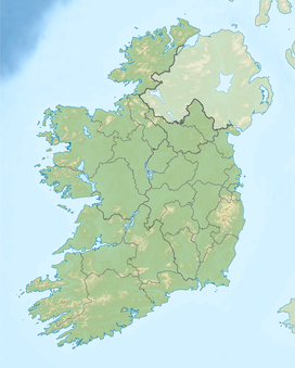
Mount Brandon
| Mount Brandon | |
|---|---|
| Cnoc Bréanainn | |

|
|
| Highest point | |
| Elevation | 953 m (3,127 ft) |
| Prominence | 934 m (3,064 ft) Ranked 10th in British Isles |
| Listing | Hewitt, Marilyn, Furth |
| Coordinates | 52°14′07″N 10°15′16″W / 52.235188°N 10.254350°WCoordinates: 52°14′07″N 10°15′16″W / 52.235188°N 10.254350°W |
| Naming | |
| Translation | Brendan's hill (Irish) |
| Geography | |
|
|
|
| Parent range | Dingle Mountains; Brandon Range |
| OSI/OSNI grid | Q460116 |
| Topo map | OSI Discovery #70 |
Mount Brandon or Brandon Mountain (Irish: Cnoc Bréanainn, meaning "Brendan's hill") is a 952 m (3123 ft) mountain on the Dingle Peninsula in County Kerry, Ireland. It is the highest peak of the unnamed central mountain range of the Dingle Peninsula and the ninth highest peak on the island. It is also the highest Irish peak outside the Macgillycuddy's Reeks. It is classed as a Furth by the Scottish Mountaineering Club. Mount Brandon is named after Saint Brendan and is the end of a Christian pilgrimage trail known as Cosán na Naomh. The small village of Brandon lies at the foot of the mountain, on the north side.
The mountain takes its name from Saint Brendan or Bréanainn, who is said to have been born in what is now County Kerry. Brendan is chiefly known for his legendary voyage to the "Isle of the Blessed", also called Saint Brendan's Island. The tale of Brendan's voyage may be a Christianization of the earlier Voyage of Bran.
A medieval work about Brendan's life calls the mountain Sliabh nDaidche (in the Irish version Beatha Bhréanainn) or Mons Aitche (in the Latin version Vita Brendani), and Alan Mac an Bhaird has translated this as "mountain of Faithche". However, some believe the name refers to Slieve Aughty rather than Mount Brandon.
Due to its link with Saint Brendan, the mountain is popular with Irish Catholic pilgrims. The path to the peak is marked by small white crosses and the peak itself is topped by a large metal cross. The pilgrimage route called Cosán na Naomh ("The Saints Road") begins at Cill Mhic an Domhnaigh (Kilvickadowning) at the southern end of the Dingle peninsula and ends at Séipéilín Bréanainn ("Brendan's Oratory") on the mountain's peak.Sáipéilín Bréanainn is the remains of a small stone building that was believed to have been used by Saint Brendan. It is likely that the pilgrimage originated in pre-Christian times and was originally a Lughnasadh ritual. The mountain's importance may be due to the fact that, being so far west and so high, it is the last place where the sun can be seen before it sets.
...
Wikipedia

