Mound Bayou
| Mound Bayou, Mississippi | |
|---|---|
| City | |
 |
|
| Nickname(s): Jewel of the Delta | |
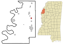
 Location of Mound Bayou in Mississippi |
|
| Location in the United States | |
| Coordinates: 33°52′50″N 90°43′41″W / 33.88056°N 90.72806°WCoordinates: 33°52′50″N 90°43′41″W / 33.88056°N 90.72806°W | |
| Country | United States |
| State | Mississippi |
| County | Bolivar |
| Founded | July 12, 1887 |
|
Incorporated -City status |
February 23, 1898 May 12, 1972 |
| Government | |
| • Mayor | Darryl Johnson |
| Area | |
| • Total | 0.9 sq mi (2.3 km2) |
| • Land | 0.9 sq mi (2.3 km2) |
| • Water | 0 sq mi (0 km2) |
| Elevation | 144 ft (44 m) |
| Population (2010) | |
| • Total | 1,533 |
| • Density | 1,749/sq mi (675.3/km2) |
| Time zone | CST (UTC-6) |
| • Summer (DST) | CDT (UTC-5) |
| ZIP code | 38762 |
| Area code(s) | 662 |
| FIPS code | 28-49320 |
| GNIS feature ID | 0673895 |
Mound Bayou is a city in Bolivar County, Mississippi, United States. The population was 1,533 at the 2010 census, down from 2,102 in 2000. It is notable for having been founded as an independent black community in 1887 by former slaves led by Isaiah Montgomery.
Mound Bayou has a 98.6 percent African-American majority population, one of the largest of any community in the United States. The current mayor of Mound Bayou is Darryl R. Johnson.
U.S. Routes 61 and 278 bypass Mound Bayou to the west and lead south 9 miles (14 km) to Cleveland, the largest city in Bolivar County, and north 27 miles (43 km) to Clarksdale.
According to the United States Census Bureau, the city of Mound Bayou has a total area of 0.9 square miles (2.3 km2), all land.
As of the 2010 United States Census, there were 1,533 people residing in the city. The racial makeup of the city was 98.0% Black, 0.9% White, 0.1% Asian and 0.1% from two or more races. 0.9% were Hispanic or Latino of any race.
As of the census of 2000, there were 2,102 people, 687 households, and 504 families residing in the city. The population density was 2,395.1 people per square mile (922.3/km²). There were 723 housing units at an average density of 823.8 per square mile (317.2/km²). The racial makeup of the city was 98.43% African American, 0.05% Native American, 0.24% Asian, 0.81% White, 0.05% from other races, and 0.43% from two or more races. Hispanic or Latino of any race were 0.38% of the population.
...
Wikipedia

