Montvale, New Jersey
| Montvale, New Jersey | |
|---|---|
| Borough | |
| Borough of Montvale | |

Corporate headquarters of The Great Atlantic & Pacific Tea Company, parent company of A&P grocery stores. (A&P ceased operations in 2015.)
|
|
 Map highlighting Montvale's location within Bergen County. Inset: Bergen County's location within New Jersey. |
|
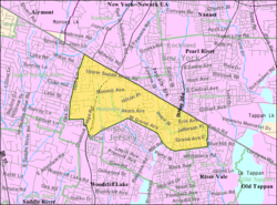
 Census Bureau map of Montvale, New Jersey |
|
| Coordinates: 41°03′17″N 74°02′50″W / 41.054594°N 74.047298°WCoordinates: 41°03′17″N 74°02′50″W / 41.054594°N 74.047298°W | |
| Country | |
| State |
|
| County | Bergen |
| Incorporated | August 31, 1894 |
| Government | |
| • Type | Borough |
| • Body | Borough Council |
| • Mayor | Michael Ghassali (I, term ends December 31, 2019) |
| • Administrator / Clerk | Maureen Iarossi-Alwan |
| Area | |
| • Total | 4.009 sq mi (10.383 km2) |
| • Land | 4.000 sq mi (10.359 km2) |
| • Water | 0.009 sq mi (0.024 km2) 0.23% |
| Area rank | 298th of 566 in state 21st of 70 in county |
| Elevation | 338 ft (103 m) |
| Population (2010 Census) | |
| • Total | 7,844 |
| • Estimate (2015) | 8,442 |
| • Rank | 292nd of 566 in state 49th of 70 in county |
| • Density | 1,961.2/sq mi (757.2/km2) |
| • Density rank | 294th of 566 in state 57th of 70 in county |
| Time zone | Eastern (EST) (UTC-5) |
| • Summer (DST) | Eastern (EDT) (UTC-4) |
| ZIP code | 07645 |
| Area code(s) | 201 |
| FIPS code | 3400347610 |
| GNIS feature ID | 0885306 |
| Website | www |
Montvale is a borough in Bergen County, New Jersey, United States. As of the 2010 United States Census, the borough's population was 7,844, reflecting an increase of 810 (+11.5%) from the 7,034 counted in the 2000 Census, which had in turn increased by 88 (+1.3%) from the 6,946 counted in the 1990 Census.
Montvale was incorporated as a borough on August 31, 1894, from portions of Orvil Township and Washington Township. The borough was formed during the "Boroughitis" phenomenon then sweeping through Bergen County, in which 26 boroughs were formed in the county in 1894 alone. On February 15, 1896, Montvale acquired part of Orvil Township. In 1906, Montvale added further land from Orvil and Washington townships, and in 1912, Montvale added territory from Upper Saddle River. On May 20, 1959, portions of Montvale were passed to River Vale, and on December 9 and 14, 1965, territories were exchanged between Montvale and Upper Saddle River. The borough's name is derived from its topography.
According to the United States Census Bureau, the borough had a total area of 4.009 square miles (10.383 km2), including 4.000 square miles (10.359 km2) of land and 0.009 square miles (0.024 km2) of water (0.23%).
The borough borders six neighboring municipalities: Woodcliff Lake, Upper Saddle River, Park Ridge, and River Vale in Bergen County; and both Pearl River (in the Town of Orangetown) and Chestnut Ridge (in the Town of Ramapo) in Rockland County, New York.
...
Wikipedia
