Montgomeryshire
| Montgomeryshire Welsh: Sir Drefaldwyn |
|
|---|---|
 |
|
 Ancient extent of Montgomeryshire |
|
| Area | |
| • 1831 | 483,323 acres (1,955.94 km2) |
| • 2011 | 537,000 acres (2,170 km2) |
| Population | |
| • 1831 | 66,482 |
| • 2011 | 63,779 |
| Density | |
| • 1831 | 0.1/acre |
| History | |
| • Succeeded by | Powys |
| Chapman code | MGY |
| Government | Montgomeryshire County Council (1889–1974) Montgomeryshire District Council (1974–1996) |
| • HQ | Montgomery |
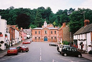
Montgomeryshire, also known as Maldwyn (Welsh: Sir Drefaldwyn meaning "the Shire of Baldwin's town") is one of thirteen historic counties and a former administrative county of Wales. It is named after its county town, Montgomery, which in turn is named after one of William the Conqueror's main counsellors, Roger de Montgomerie, who was the 1st Earl of Shrewsbury.
Montgomeryshire today constitutes the northern part of the principal area of Powys. The population of Montgomeryshire was 63,779 according to the 2011 census, with a low population density of 29 people per square km. The current area is 2,174 square km (839 square miles).
The largest town is Newtown, followed by Welshpool and Llanidloes.
The Treaty of Montgomery was signed in Montgomeryshire on 29 September 1267.
With the introduction of the Laws in Wales Acts 1535–1542 the marcher lordships were incorporated into the new counties of Denbighshire and Montgomeryshire. In terms of historic counties, Montgomeryshire is bounded to the north by Denbighshire, to the east and south east by Shropshire (an English county), to the south by Radnorshire, to the south west by Cardiganshire and to the west and north west by Merionethshire.
...
Wikipedia
