Monte Titano
| Mount Titano | |
|---|---|

Monte Titano and three fortresses on top of it can be seen from many kilometers away.
|
|
| Highest point | |
| Elevation | 739 m (2,425 ft) |
| Prominence | 189 m (620 ft) |
| Listing | Country high point |
| Coordinates | 43°55′42″N 12°27′08″E / 43.92833°N 12.45222°ECoordinates: 43°55′42″N 12°27′08″E / 43.92833°N 12.45222°E |
| Geography | |
| Location | San Marino |
| Parent range | Apennines |
| Official name | San Marino Historic Centre and Mount Titano |
| Type | Cultural |
| Criteria | iii |
| Designated | 2008 (32nd session) |
| Reference no. | 1245 |
| State Party | San Marino |
| Region | Europe and North America |
Monte Titano ("Mount Titan") is a mountain of the Apennines and the highest peak in San Marino. It stands at 739 m (2,425 ft) above sea level and is located immediately to the east of the capital, San Marino. It was inscribed as a UNESCO World Heritage Site in 2008 under the combined title "San Marino Historic Centre and Mount Titano". Inscribed under reference no. 1245 criteria iii, the two together encompass an area of 55 ha with a buffer zone of 167 ha. It encompasses Mount Titano and the other structures such as the fortification towers, walls, gates and bastions, as well as a neo-classical basilica located on it and its slopes forming a small but unique urban conglomerate.
Straddled on the ridge of Mount Titano is the city of San Marino of the Republic of San Marino, the history of which dates from the early 4th century. According to the legend related to the Mount and its precincts a small monastery existed on top of the Mount during the 8th century. The mountainous landscape provides excellent views of its surroundings, and its isolated location ensured the needed seclusion for San Marino to survive as a Republic over the past several centuries.
The mountain has three peaks; on each is one of The Three Towers of San Marino. Saint Marinus is always represented with Mount Titano in his hands.
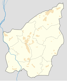
Monte Titano is located in central San Marino (seen in maps in rough rectangular shape), to the southeast of the City of San Marino and to the north of the village of Murata, at a distance of 10 km (6.2 mi) from the Adriatic Coast. Monte Titano looks like a rugged limestone outcrop, located only 13 kilometres (a figure of 10 km is mentioned in another reference) from the Adriatic Sea on the Apennines. Although the highest point is 739 metres above sea level, the rocky outcrop is about 200 metres in height at most. From the top of Monte Titano views of the entire nation of San Marino and further afield can be viewed scenically. The mountain gives birth to several streams, including the San Marino River, which flows down its western slope through a broad valley and flows into the Marecchia River, through Marecchia Torello and into the Adriatic Sea 23 km (14 mi) away and the Cando River, born in Marano, which flows into the Adriatic coast between Rimini and Riccione Ausa. The terrain has fertile soils in Emilia Romagna plain and soft rolling hills in the Marche and Montefeltro region. The mountain dips into the calm Adriatic sea.
...
Wikipedia

