Montclair, Virginia
| Montclair, Virginia | |
|---|---|
| Census-designated place (CDP) | |
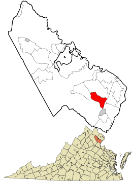
 Location in Prince William County and the state of Virginia. |
|
| Coordinates: 38°36′57″N 77°20′35″W / 38.61583°N 77.34306°WCoordinates: 38°36′57″N 77°20′35″W / 38.61583°N 77.34306°W | |
| Country | United States |
| State | Virginia |
| County | Prince William |
| Area | |
| • Total | 6.2 sq mi (16.0 km2) |
| • Land | 6.0 sq mi (15.6 km2) |
| • Water | 0.1 sq mi (0.3 km2) |
| Elevation | 125 ft (38 m) |
| Population (2010) | |
| • Total | 19,570 |
| • Density | 3,200/sq mi (1,200/km2) |
| Time zone | Eastern (EST) (UTC-5) |
| • Summer (DST) | EDT (UTC-4) |
| ZIP code | 22025 |
| Area code(s) | 571, 703 |
| FIPS code | 51-52658 |
| GNIS feature ID | 1867595 |
Montclair is a census-designated place (CDP) in Prince William County, Virginia, United States. The population was 19,570 at the 2010 census. Montclair is an affluent residential community surrounding a man-made lake and golf course. Development began in the late 1960s and new home construction for the most part ended in the 1990s. Traditionally, residents of Montclair used the mailing address and ZIP code of Dumfries, although the town of Dumfries is several miles from Montclair. More recently, the United States Postal Service allowed residents to use "Montclair, VA" in their mailing address and on July 1, 2005, Montclair was given a separate ZIP code (22025).
Montclair is located at 38°36′57″N 77°20′35″W / 38.61583°N 77.34306°W (38.615881, -77.343042).
According to the United States Census Bureau, the CDP has a total area of 6.2 square miles (16.0 km²), of which, 6.0 square miles (15.6 km²) of it is land and 0.1 square miles (0.3 km²) of it (2.11%) is water.
The heart of Montclair is Lake Montclair, which was created by damming the waters of Powell's Creek. The lake branches out in a forked pattern to accommodate the flow from storm drains. The lake is 25' deep off of Dolphin Beach, but potentially much deeper in the open water.
As of the census of 2000, there were 15,728 people, 5,084 households, and 4,326 families residing in the CDP. The population density was 2,605.0 people per square mile (1,005.4/km²). There were 5,184 housing units at an average density of 858.6/sq mi (331.4/km²). The racial makeup of the CDP was 77.63% White, 14.71% African American, 0.41% Native American, 3.02% Asian, 0.20% Pacific Islander, 1.08% from other races, and 2.94% from two or more races. Hispanic or Latino of any race were 4.51% of the population.
...
Wikipedia
