Monroe, Ohio
| Monroe, Ohio | |
|---|---|
| City | |

|
|
| Motto: "firmly founded - proudly growing" | |
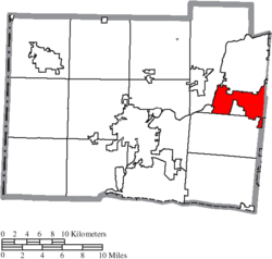
 Location of Monroe, Ohio |
|
 Location of Monroe in Butler County |
|
| Coordinates: 39°26′41″N 84°21′51″W / 39.44472°N 84.36417°WCoordinates: 39°26′41″N 84°21′51″W / 39.44472°N 84.36417°W | |
| Country | United States |
| State | Ohio |
| Counties | Butler, Warren |
| Area | |
| • Total | 15.89 sq mi (41.15 km2) |
| • Land | 15.87 sq mi (41.10 km2) |
| • Water | 0.02 sq mi (0.05 km2) |
| Elevation | 833 ft (254 m) |
| Population (2010) | |
| • Total | 12,442 |
| • Estimate (2012) | 12,844 |
| • Density | 784.0/sq mi (302.7/km2) |
| Time zone | Eastern (EST) (UTC-5) |
| • Summer (DST) | EDT (UTC-4) |
| ZIP codes | 45050, 45073, 45099 |
| Area code(s) | 513 |
| FIPS code | 39-51310 |
| GNIS feature ID | 1061157 |
| Website | City website |
Monroe is a city located in east central Butler and west central Warren counties in the southwestern part of the U.S. state of Ohio. As of the 2010 Census, the city population was 12,442, up from 4,008 in 1990.
Monroe was laid out in 1817 on the Dayton and Cincinnati pike. The city is named for President James Monroe, fifth President of the United States.
In the early 1830s, Monroe contained one store and 119 inhabitants.
Monroe is located at 39°26′41″N 84°21′51″W / 39.44472°N 84.36417°W (39.444658, −84.364044).
According to the United States Census Bureau, the city has a total area of 15.89 square miles (41.15 km2), of which 15.87 square miles (41.10 km2) is land and 0.02 square miles (0.05 km2) is water.
As of the census of 2010, there were 12,442 people, 4,649 households, and 3,481 families residing in the city. The population density was 784.0 inhabitants per square mile (302.7/km2). There were 4,896 housing units at an average density of 308.5 per square mile (119.1/km2). The racial makeup of the city was 92.6% White, 3.7% African American, 0.2% Native American, 1.7% Asian, 0.7% from other races, and 1.3% from two or more races. Hispanic or Latino of any race were 1.8% of the population.
...
Wikipedia
