Monroe, Maine
| Monroe, Maine | |
|---|---|
| Town | |
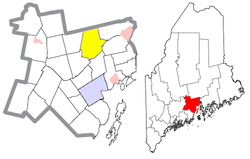
 Location of Monroe (in yellow) in Waldo County and the state of Maine |
|
| Coordinates: 44°35′59″N 69°2′44″W / 44.59972°N 69.04556°W | |
| Country | United States |
| State | Maine |
| County | Waldo |
| Area | |
| • Total | 39.03 sq mi (101.09 km2) |
| • Land | 38.92 sq mi (100.80 km2) |
| • Water | 0.11 sq mi (0.28 km2) |
| Elevation | 371 ft (113 m) |
| Population (2010) | |
| • Total | 890 |
| • Estimate (2012) | 893 |
| • Density | 22.9/sq mi (8.8/km2) |
| Time zone | Eastern (EST) (UTC-5) |
| • Summer (DST) | EDT (UTC-4) |
| ZIP code | 04951 |
| Area code(s) | 207 |
| FIPS code | 23-46475 |
| GNIS feature ID | 0582602 |
Monroe is a town in Waldo County, Maine, United States named for President James Monroe. The population was 890 at the 2010 census.
According to the United States Census Bureau, the town has a total area of 39.03 square miles (101.09 km2), of which, 38.92 square miles (100.80 km2) of it is land and 0.11 square miles (0.28 km2) is water. Principle bodies of water include: Chase Bog Pond (67 acres), Basin Pond (28 acres), Lily Pond (27 acres), Thistle Pond (16 acres) and Northern Pond (15 acres).
Monroe is located at the intersection of Routes 139 and 141. It is bordered on the north by Newburgh, on the east by Winterport and Frankfort, one the south by Swanville, on the southwest by Brooks, on the west by Jackson and on the northwest by Dixmont.
As of the census of 2010, there were 890 people, 402 households, and 247 families residing in the town. The population density was 22.9 inhabitants per square mile (8.8/km2). There were 461 housing units at an average density of 11.8 per square mile (4.6/km2). The racial makeup of the town was 97.6% White, 0.2% African American, 0.2% Asian, and 1.9% from two or more races. Hispanic or Latino of any race were 1.2% of the population.
...
Wikipedia
