Mohaka River
| Mohaka River | |
|---|---|
| Country | New Zealand |
| Basin features | |
| Main source | Kaimanawa Range |
| River mouth |
Hawke Bay 0.0 metres (0 ft) |
| Physical characteristics | |
| Length | 172 kilometres (107 mi) |
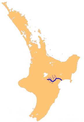
The Mohaka river is on the North Island of New Zealand in the east central region of Hawke’s Bay. Mohaka is a Maori word, roughly translated it means “place for dancing”. The iwi (Māori tribes) associated with the Mohaka River are Ngāti Pāhauwera, Ngāti Hineuru, Ngāti Tūwharetoa and Mana Ahuriri. The headwaters are found in the Kaweka and Kaimanawa ranges. From the range it winds southeast before twisting northeast and finally southeast again to empty into the Pacific Ocean near the town of Mohaka. There are many gorges on the Mohaka; some as steep as 200m (656 feet). Its main tributaries are the Waipunga, Taharua, Hautapu rivers. The full length is 172 kilometres (107 mi) and it drains a basin of 2,357 square kilometres (910 sq mi).
Ngati Pahauwera’s traditional tribal territory is from the Te Hoe river junction to its mouth. The river, including its waters, bed and fisheries, is a taonga of Ngati Pahauwera. In particular they place great emphasis on the role the river plays in their tribal identity.
The Mohaka was an important river for fishing and transport long before the settlers arrived. Archeological surveys have found extensive evidence of villages and temporary camps along the lower and upper Mohaka. The Maori collected Hangi stones, taupunga, opunga, poutama, kowhaturi from the riverbed.
The famous Maori, Te Kooti, reportedly frequented the area. Te Kooti’s Lookout, said to be the sight of a fight with the British, is visible from the river. Later, Europeans used the Mohaka to transport timber. In 2004 a water conservation order was placed on the upper section of the Mohaka because of its fantastic fishing, scenic gorges and outstanding amenity for recreation. The area is also an important habitat for the rare blue duck.
More recently it is a popular spot for rafting, kayaking, tramping and fishing.
Up in the Kaweka range the Mohaka is a twisting grade II river with a bit of grade III. There are several Department of Conservation (DOC) campsites, hot pools and plenty of undisturbed native bush. After approximately 36 km, it comes out of the Kawekas and farmland becomes more common The river bends it self into an oxbow and shortly after rapids become larger as it leads into the grade III section. DOC campsites are still found along this 68 km stretch.
...
Wikipedia

