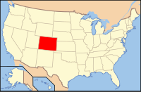
Moffat County
| Moffat County, Colorado | |
|---|---|

Wolf Creek Wildlife Management Area in Moffat County, Colorado
|
|
 Location in the U.S. state of Colorado |
|
 Colorado's location in the U.S. |
|
| Founded | February 27, 1911 |
| Named for | David H. Moffat |
| Seat | Craig |
| Largest city | Craig |
| Area | |
| • Total | 4,751 sq mi (12,305 km2) |
| • Land | 4,743 sq mi (12,284 km2) |
| • Water | 7.6 sq mi (20 km2), 0.2% |
| Population (est.) | |
| • (2015) | 12,937 |
| • Density | 2.9/sq mi (1/km²) |
| Congressional district | 3rd |
| Time zone | Mountain: UTC-7/-6 |
| Website | www |
Moffat County is the northwesternmost of the 64 counties in the U.S. state of Colorado. As of the 2010 census, the population was 13,795. The county seat is Craig.
Moffat County comprises the Craig, CO Micropolitan Statistical Area, which is also included in the Steamboat Springs-Craig, CO Combined Statistical Area.
Moffat County was created out of the western portion of Routt County on February 27, 1911. The county was named for David H. Moffat, a Colorado tycoon who died in 1911. His railroad, the Denver, Northwestern & Pacific, attempted to build a route from Denver to Salt Lake City. In 1913, a reorganized railroad, the Denver & Salt Lake, reached as far as Craig, the county seat, but no further. In the late 1890s and early 1900s, all Colorado District Courts were held in Denver, Colorado, in the State courthouse there, due to a lack of funds to build courthouses locally. All murder trials were held in Denver, in the District Courts. Allegedly, so many politically motivated murders occurred between the predominantly liberal, then, eastern Routt County, Colorado residents and the predominantly conservative, then, western Routt County residents, that the presiding judges—tired of presiding over these murder trials—requested that the State legislature split Routt County into what is now Routt and Moffat County; the legislature complied.
According to the U.S. Census Bureau, the county has a total area of 4,751 square miles (12,310 km2), of which 4,743 square miles (12,280 km2) is land and 7.6 square miles (20 km2) (0.2%) is water. It is the second-largest county by area in Colorado.
...
Wikipedia
